
Redesigning places to better support safe, comfortable walking and cycling is not hard, and often the tools needed already exist at the local level. It just requires a little bit of imagination!
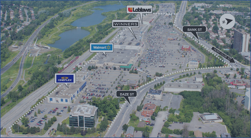
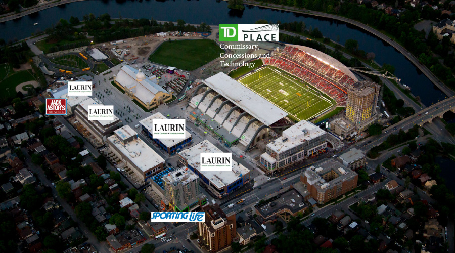
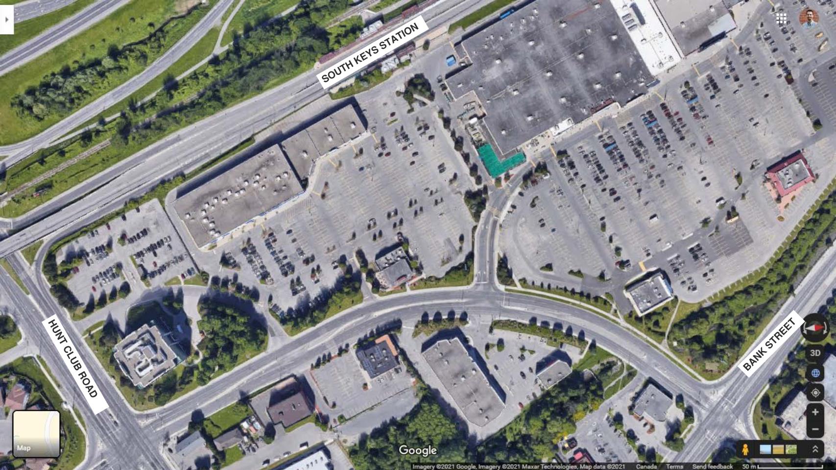
Located eight kilometres south of downtown Ottawa, South Keys Centre is an unremarkable place. That’s not to say it isn’t a place – it’s full of retail and often quite busy – there just isn’t anything unique or differentiating about it. Its chain stores offer the same products as the next shopping centre over, and there’s more asphalt than buildings covering the expansive site. It’s one of many cookie-cutter big-box retail plazas that Ottawa and North America is ripe with.
But as cities and communities refocus to become more urban, sustainable, and people-focused, places like South Keys Centre (SKC) are of great interest. These places, once icons of car-centric development, can be reimagined to be catalysts for change, transforming into vibrant new community centres and showing that “downtown” style amenities don’t require a drive or hour-long transit journey to experience.
If we can get places like South Keys Centre right, change might not be so hard after all (and much more enjoyable, really). In this post, I’ll dive into SKC, my challenges with the current design and proposed plans, and some ideas for making it better.
Why Should We Care About This Place?
As I mentioned, SKC is similar to other suburban commercial areas in many ways, but there are some key distinguishing factors that need to be accounted for:
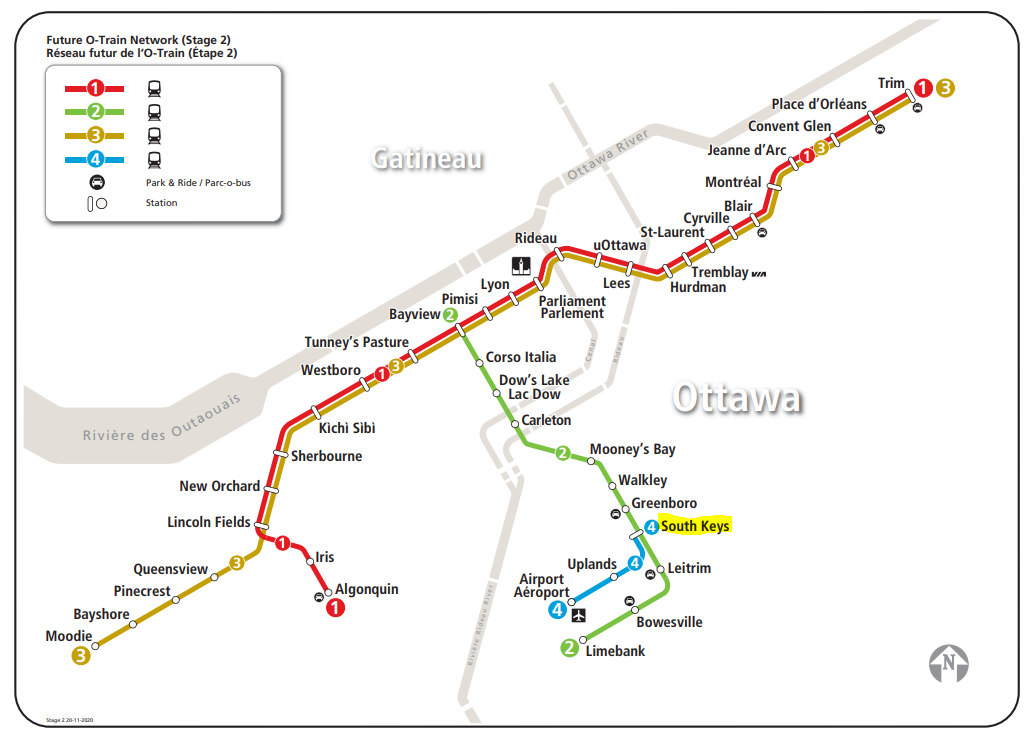
It’s very well-connected: SKC is anchored by South Keys Transitway station, an existing hub for local bus service providing rapid & frequent bus and rail (beginning 2022) connections along a north-south spine through Ottawa. Hop on a bus or a train and in 20-30 minutes you can be transported to Carleton University, University of Ottawa, the Central Business District, Little Italy, the ByWard Market, the Ottawa International Airport and even Barrhaven. Beyond transit, SKC is adjacent to Hunt Club Road, a major ring road around the inner greenbelt and a major goods movement route, as well as Bank Street, one of Ottawa’s oldest and most economically productive streets.
It’s close to the airport: Airport proximity is a major asset for a community and a draw for jobs and industry (it’s the reason why the Toronto Pearson Airport employment area generates 1,000,000 daily trips). Airport proximity provides internationally-focused companies with easy access to goods and people movement. For locals and visitors, it’s a natural hub for hotels, especially given the new airport rail link that will connect South Keys directly to the airport beginning 2022. For airport workers, it’s a place to live with an easy commute to work.
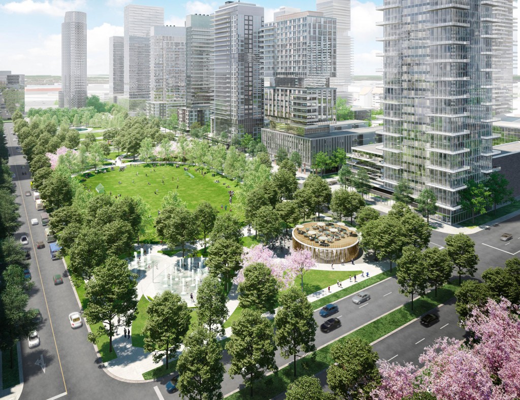
It’s ripe for transformation: Today, SKC is occupied mostly by the 56-acre South Keys Shopping Centre, a big-box style development that’s been mostly unchanged since the 1990’s. While it’s certainly a popular and well-used commercial destination, the number of empty stores has increased since the pandemic (currently 6) and with the larger trend towards online retail, it’s likely that the Centre’s owner, SmartCentresREIT, will be eyeing the potential to get more value out of the property with a mixed-use development. In fact, SmartCentres is actively doing just that with many of its GTA properties like the Vaughan Metropolitan Centre, a massive new downtown for Vaughan centred around a new subway station.
Isn’t There Already a Plan in Place?
Yes, the City has an existing secondary plan in place to help guide the redevelopment of SKC, that was finalized in 2015 with consultation from community members. One of the key flaws of the plan, however, is that it relies on a developer-driven approach to transforming the area. While this requires less capital and effort from the City, it also hands over the reins to private interests. SKC should be developed first and foremost with the public’s interest in mind. While Ottawa’s Landsdowne area is not perfect, it’s a good example of taking a holistic approach to site design and building everything out together.
In addition, I’ve reviewed the plan and have some major criticisms:
- It totally ignores the two transit stations, much like the shopping centre does today. The retail, community centre, and “town square” are proposed at the midpoint between the two stations, and people exit the stations into parks. The first thing people should experience when they exit a transit station is amenities, not parks and the backs of buildings.
- It’s missing lots of important details. The developer-driven approach means many of the details will be sorted over time as development occurs, which could be a very long time. In the meantime, as residents move in, they will be lacking key amenities to complement new density like schools and parks.
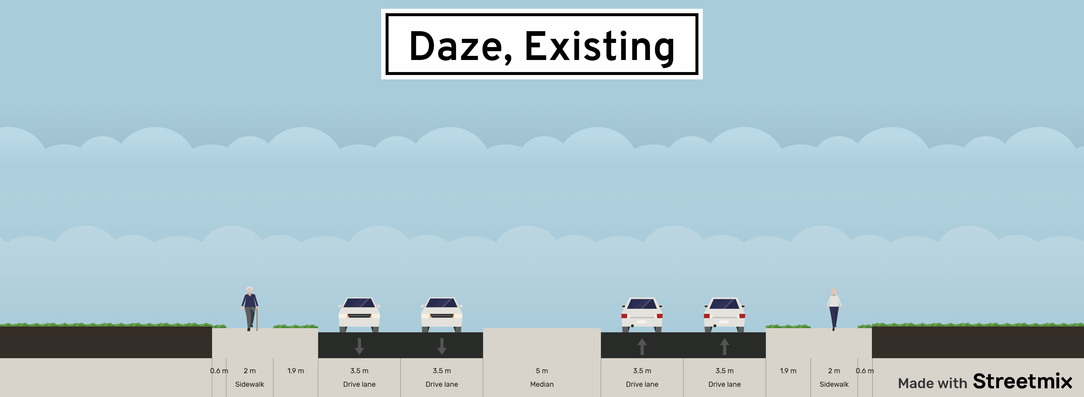
- There is no plan for how to improve Daze Street, currently a 4-6 lane roadway without cycling infrastructure that operates at 60km/h and is not supportive of the desired pedestrian-friendly environment
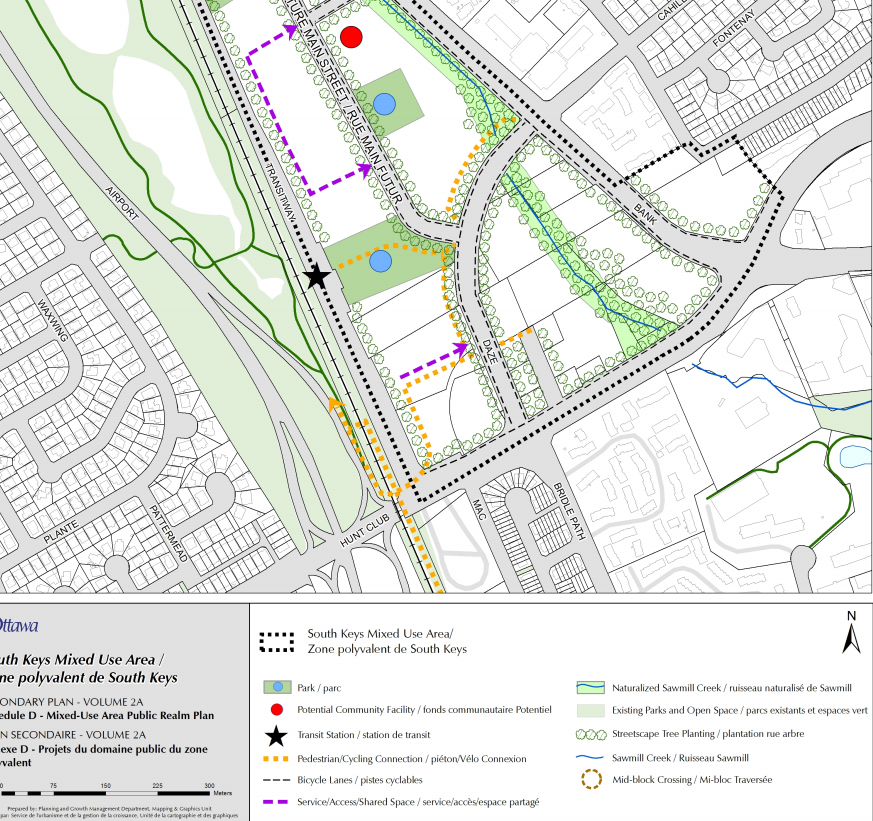
The City’s proposed public realm plan for South Keys Centre. Notice the lack of focus on the transit station and the creek, both major community assets. (Source: City of Ottawa)
A New Vision
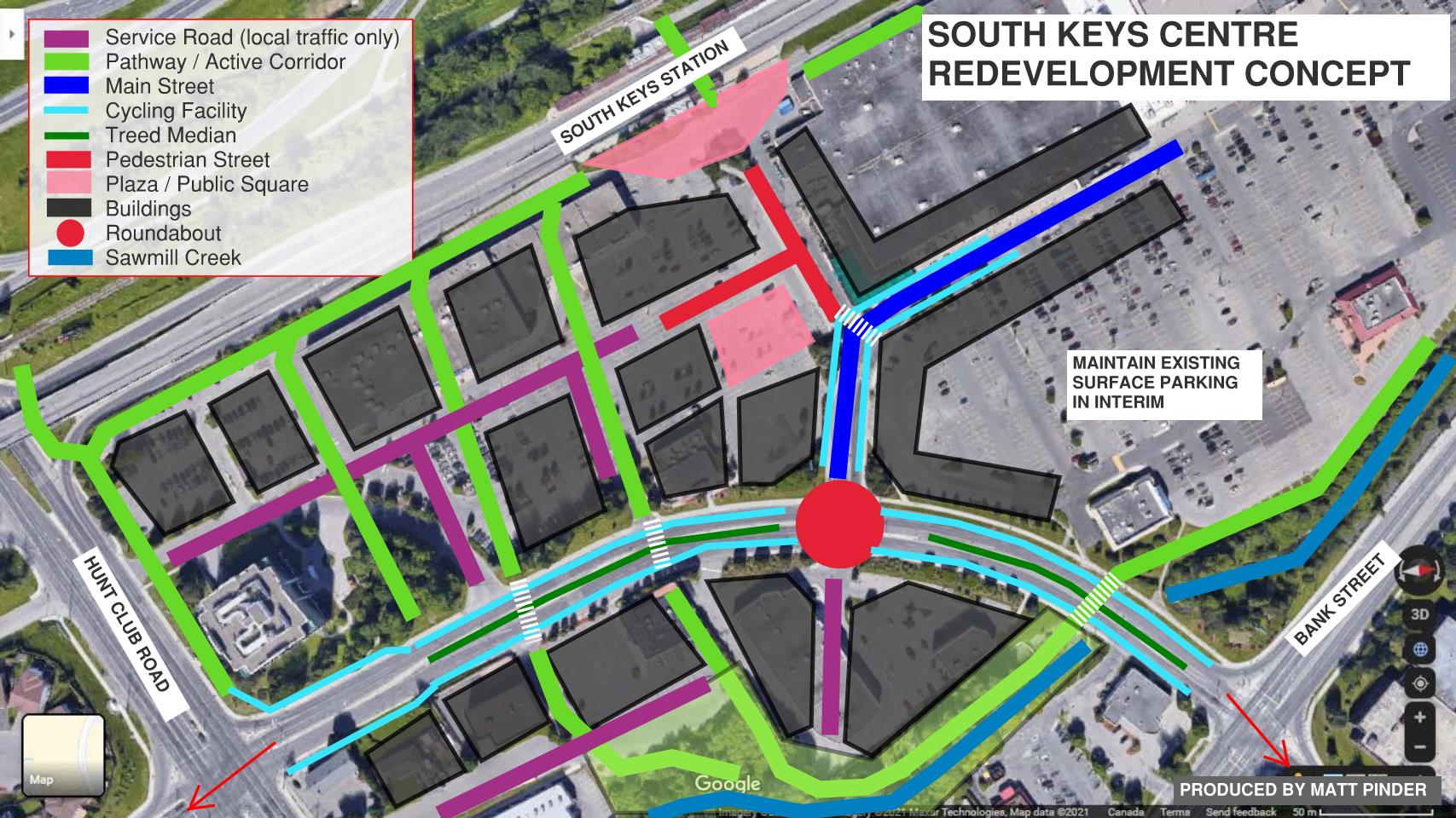
I have attempted to reimagine what the community could look like with a focus on integrating development, transportation, and urban design, drawing inspiration from great examples in Ottawa and elsewhere. I’ve focused on the south end of the secondary plan area as I think it has more “gravity” than the north end. In the next section, you’ll find a visual of the plan, with the key elements summarized below.
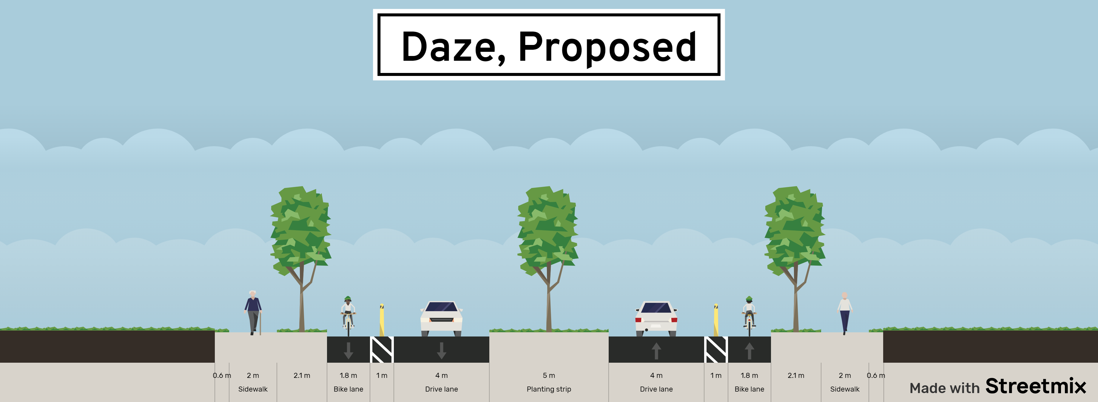
Reconfigure Daze Street with one traffic lane in each direction, a centre treed median, and on-street protected bike lanes. A roundabout is proposed where Daze intersects the new Main Street, and three midblock pedestrian crossings are proposed along Daze between Hunt Club and Bank. The proposed treed median is continuous, so most driveways are right-in-right-out. Protected intersections should be built where Daze intersects Bank and Hunt Club to create comfortable, continuous walking and cycling routes that form active transportation “spines” that continue into the adjacent Greenboro and Emerald Woods communities
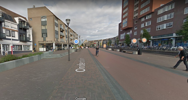
Centre the new community around South Keys station. South Keys Transitway station is the natural focal point for the community; it is the transit gateway in and out and provides walking and cycling connections across the Airport Parkway. Despite this, the current plan proposes little more than a park here, with no retail or elements to activate the space. Instead of a park, I propose to build a smaller station plaza leading to a pedestrian-only street lined with street-facing retail and extensive streetscaping and patios. For inspiration, here’s a view from Houten, a suburban community in the Netherlands, outside of the main train station.
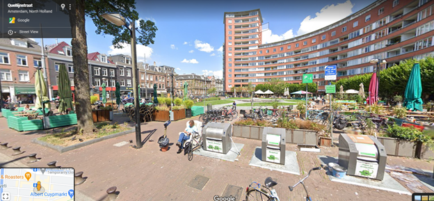
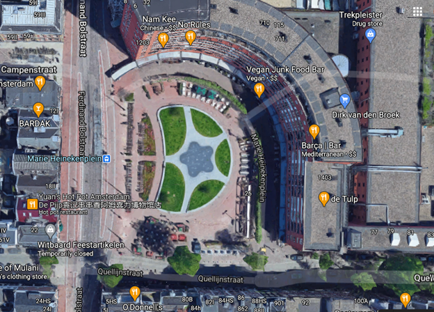
Add a grand public square. After exiting the transit station and taking a pleasant stroll down the pedestrian street, imagine a grand European-style public square, like those ones everyone loves sitting in when they go on vacation overseas. The surrounding buildings should be oriented around the square, to make it a natural destination for the community. It can contain green space, sitting space, trees, and even a skating rink in the winter. As an example, consider one of my favourite public places in Amsterdam, Marie Heinekenplein town square.
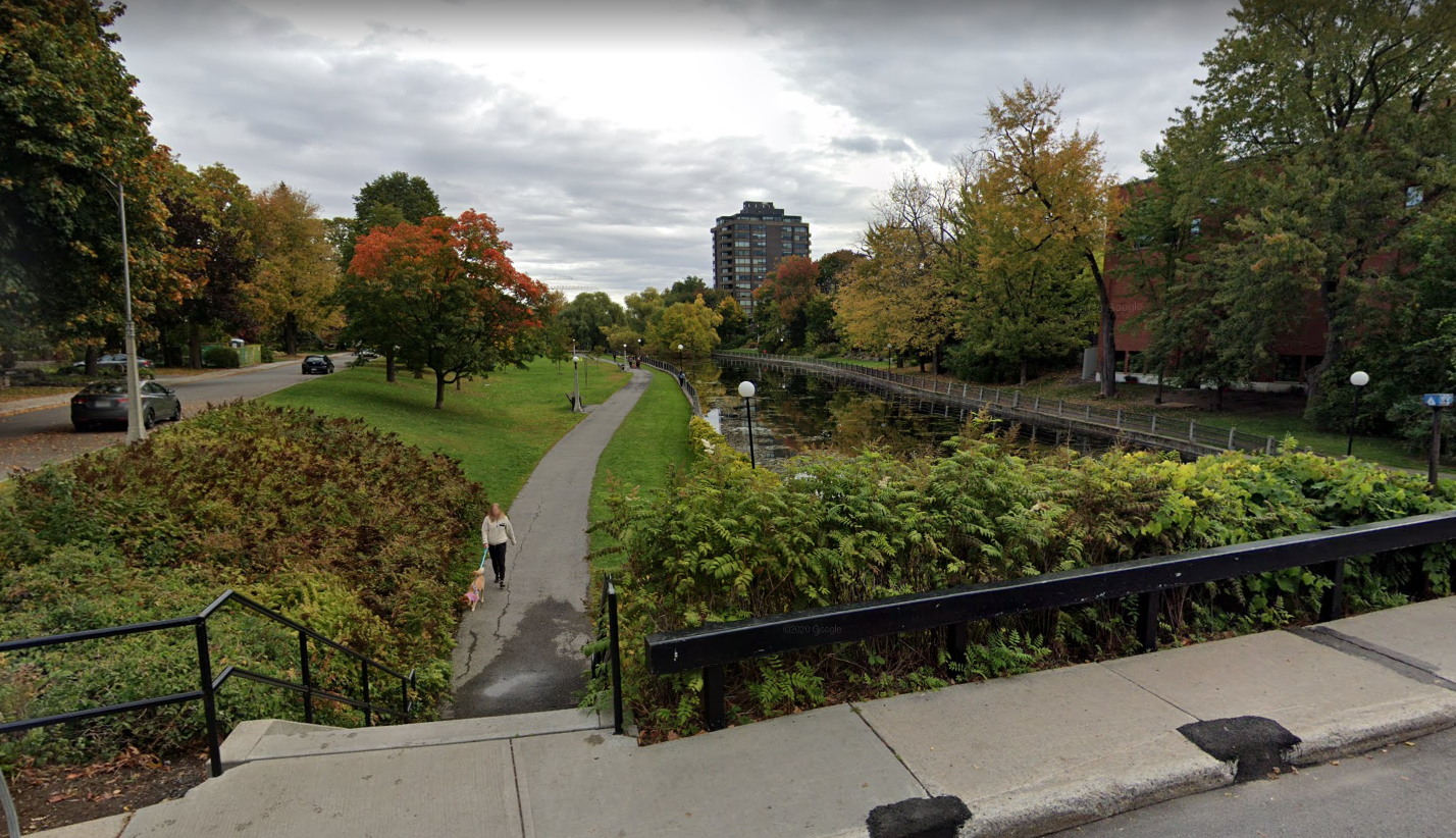
Activate Sawmill Creek. Among the tar and asphalt at SKC today lies an undervalued natural feature: Sawmill Creek. It’s currently left off to the side, and even fenced off in many places, despite hosting some beautiful mature trees and foliage. Water features are a natural draw for people, and I propose that a new linear park be constructed along Sawmill Creek, complete with an immersive recreational pathway with benches and viewpoints, that crosses Daze with pedestrian-priority crosswalks and eventually leads to South Keys station and the trails west of the tracks, creating a continuous trail experience. Here’s an example of a creek-oriented park in Ottawa’s Glebe neighbourhood.
Get Main Street Right. Design the proposed new Main Street for a speed of 30 km/h, with a tight “elbow” near the public square to slow traffic. Consider providing on-street parking on just one side (or none at all) to allow a narrower right of way. Provide continuous street-facing retail on main street with no driveways, so that the street can be closed to cars during special events. In the interim, provide surface parking lots behind those buildings. Over time, as the parking develops into buildings, the parking can be eliminated or shifted to underground garages. This is similar to the approach being taken in Markham’s new downtown, where dense, street-facing buildings are built along the main street, with large parking lots in the back that can easily redevelop over time.

Keep vehicles out of the centre. While the design should not hinder people from driving to get there, cars should be kept to the periphery as much as possible, with no vehicle traffic at all in the immediate station area (except service vehicles), and only local traffic on the main street. Service roads should have only one exit onto Daze and one onto Hunt Club to minimize any potential for cut-through traffic. They should be designed to be narrow, with 10 km/h speeds to allow the environment to be shared with pedestrians and cyclists.
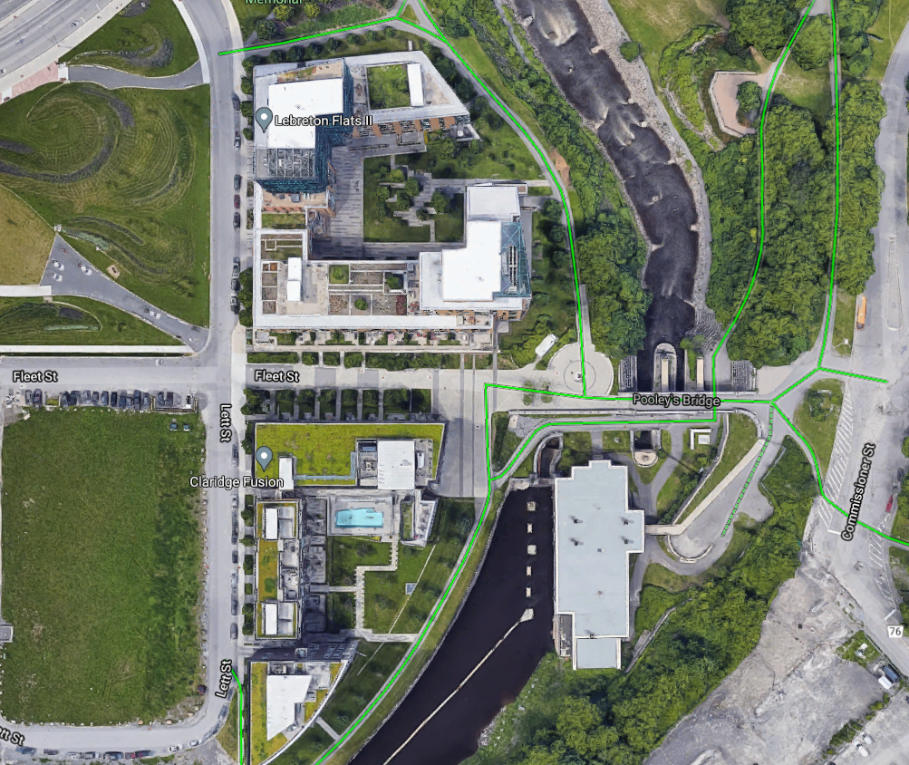
Add a Greenway to the Transitway. Create a green pathway corridor along the west edge abutting the Transitway. This will be a natural route for people to access the station and the greenspace beyond, and has potential to be a beautiful “backyard” for the community. The back side of Ottawa’s Lebreton Flats neighbourhood provides an excellent example of an “activated” exterior space that’s popular for people walking and cycling.
The Plan
Below you’ll find a basic plan outlining my high-level proposal. As a transportation engineer and not a planner, you’ll see the plan focuses more on the site transportation and people movement than the buildings themselves. Of course, this is where planners, architects, and urban designers are really helpful. My plan also only shows the immediate vicinity of South Keys station, but the concepts could be extended to cover the entire site.
Why Now?
Canada’s retail landscape is changing for good. At the same time, Cities are releasing grand vision statements to prioritize pedestrians and create walkable developments. The pandemic has served as a strong reminder of the importance of having quality outdoor public spaces, where people can walk, bike, chat with a friend, or get a drink or a meal.
South Keys Centre is experiencing these factors and more. Its owner has a proven interest and ambition in creating high-value mixed-use developments in the GTA, and beginning in 2022, SKC will be anchored with O-Train Lines 2 and 4, providing frequent rail service to a multitude of destinations. The opportunity is ripe for the picking to make SKC a vibrant new urban neighbourhood that can be a role model for other shopping centres across North America.

Great read!
Daze Street certainly needs improvement! The section between Bank and South Keys station, in particular, is a great opportunity to provide a connection from the Greenboro Pathway to the east and the transit station, Sawmill Creek Pathway, and Juno Beach Pedestrian Bridge to the west.
The CDP from 2015 (https://documents.ottawa.ca/sites/documents/files/documents/southkeys_cdp_en.pdf) looked at potentially squaring off Daze. But I’d be OK with retaining the current alignment as long as it is made a complete street.
There is an active development proposal for a 12-story apartment building on the east side of Daze near Hunt Club: https://devapps.ottawa.ca/en/applications/D02-02-20-0121/details
In addition, the section of retail between the transit station and the theatres is almost completely vacant. I’m expecting to see an apartment building proposal any time. I’m excited for the transformation of this area to begin!
LikeLike
Great read. As someone living in the area, I never understood why Daze didn’t have bike lanes or a MUP connecting to the path behind South Keys station.
LikeLike
Thanks for sharing! There’s such a good pathway network in the neighbourhood but it’s entirely recreational because of the gap through South Keys Centre. We could support so many more cycling trips by just closing this gap.
LikeLike