
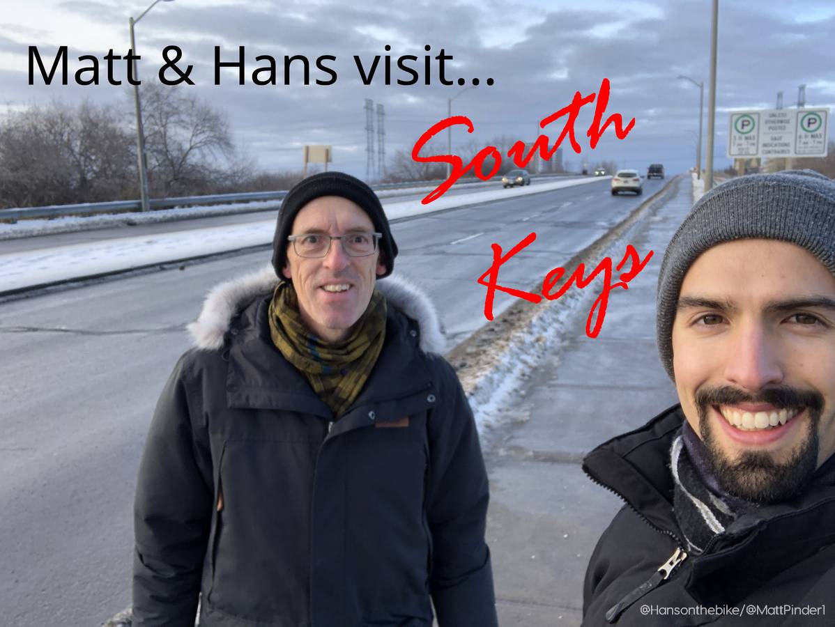
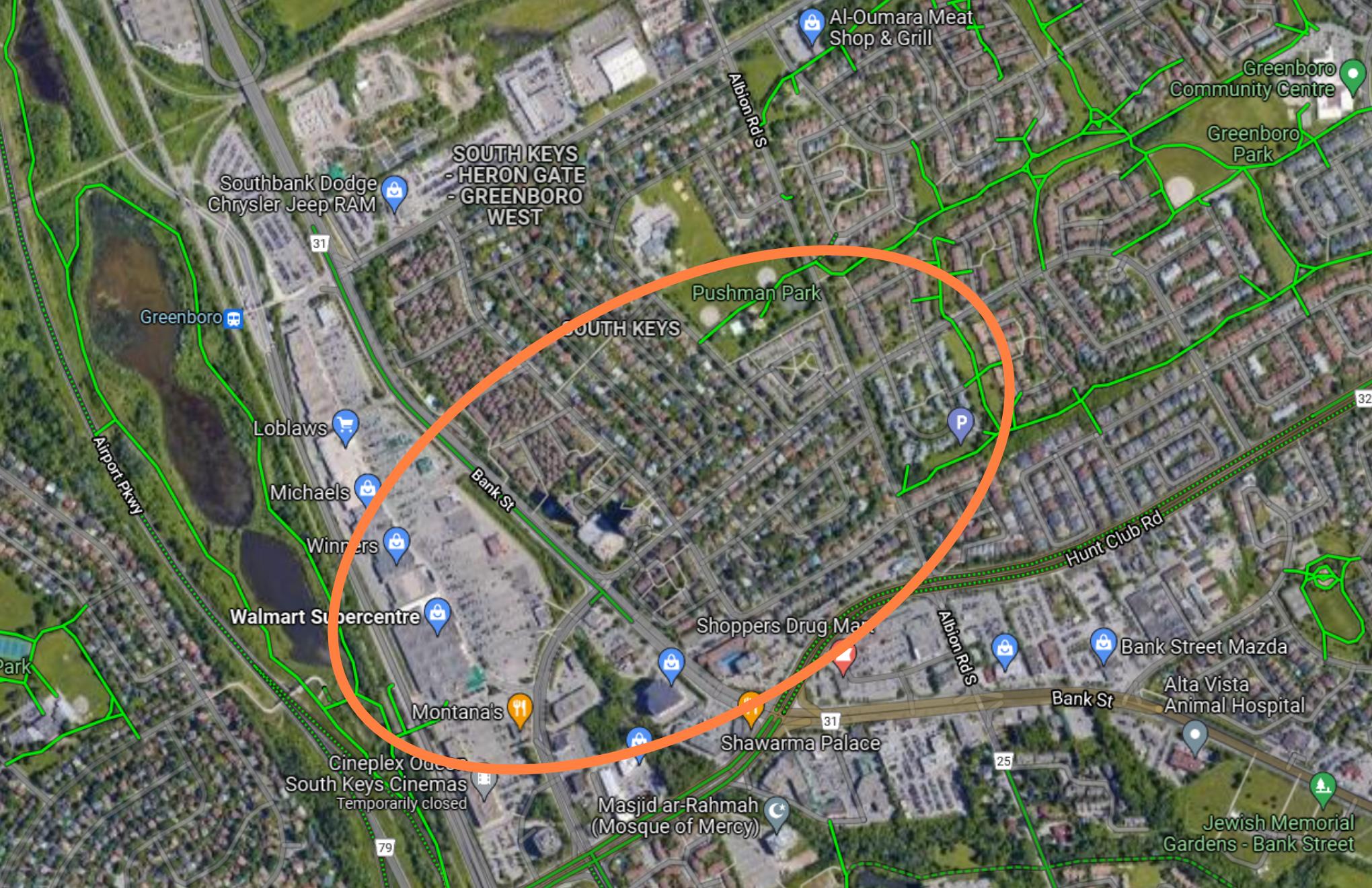
After visiting Merivale Road in the fall of 2021, Matt and Hans decided to meet up at the South Keys Shopping Centre between Christmas and New Years. With the extension of the Trillium O-Train line in 2023 to include a second station at South Keys and a new LRT connection to the airport, the area has huge potential to right the wrongs of the past: oversized parking lots, missing cycling links and empty stores.
Hans: Being a “multimodal” traveller I did take a look at the different options of getting here. I could have taken the bus as part of the “no charge transit” month but it would take me a minimum of 40 minutes plus twice waiting in sub zero temperatures along arterial roads, whereas the car would only take me 12-14 minutes. Alternatively, I could have taken the bike, but considering the weather and the lack of path maintenance, I opted for the car.
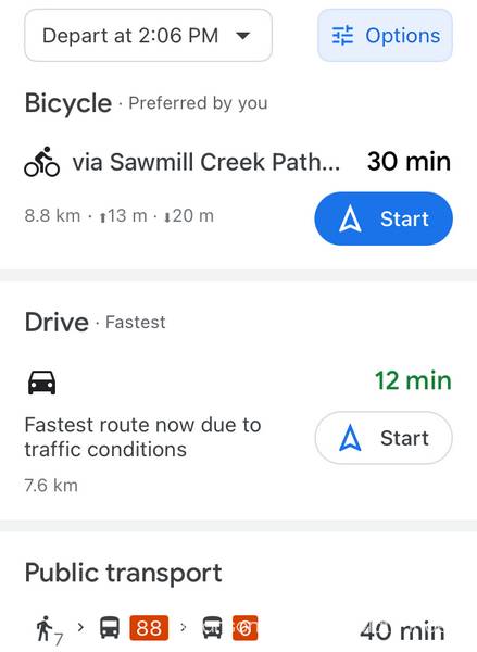
Matt: I’m not going to fault you for picking the most convenient option! Especially for suburb-to-suburb travel in Ottawa, driving is usually twice as fast at least. I do hope with the Trillium line extension and the eventual Baseline BRT though that our neighbourhoods will be better linked.
Condominium Community
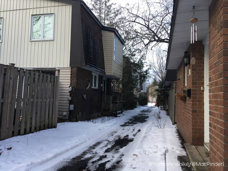
Hans: Walking around your condominium community feels a bit Dutch/Scandinavian, with centralised parking and pathways between the houses only. I dare say it comes very close to a woonerf. Why did you pick this neighbourhood Matt?
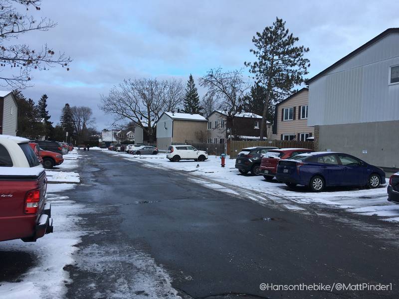
Matt: When my partner and I were looking for where to purchase a home in Ottawa, being within walking distance of rapid transit and amenities was important to us, but we had to balance that with what we could actually afford. So we based our search around LRT stations outside Ottawa’s core, and quickly found South Keys to be one of the best matches. I also really love the rich pathway network of Greenboro, and am excited about the significant potential for the South Keys mall to become a future urban hub.
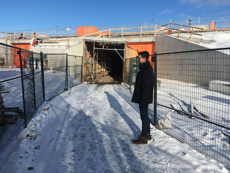
Hans: We just walked through a park and along Albion towards a road called Cahill. Why are we here?
Missing Bicycle Link
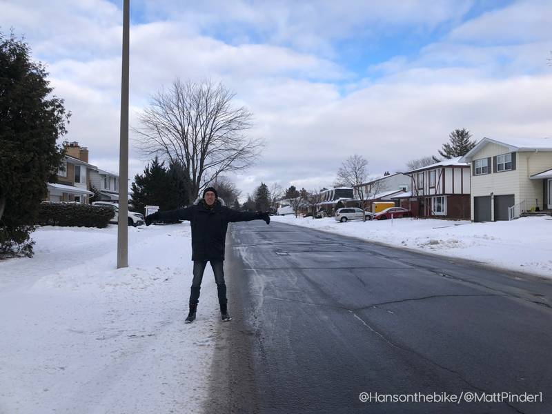
Matt: Though these streets seem like nothing special, they represent a major gap in Ottawa’s cycling network. To the east, we have the end of the Greenboro pathway network, a beautiful several kilometers of pathways that links just about all of Greenboro’s 15,000+ residents to parks, schools, and the library and community centre. To the west is South Keys Shopping Centre, the transit station, the Sawmill Creek Pathway, and the pedestrian bridge over the Airport Parkway connecting to the Owl Park neighbourhood. Separating these is a gap of about a kilometre where no cycling infrastructure exists – something I would like to see changed in the near term.
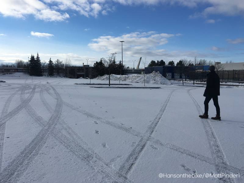
30 Acres of Asphalt
Hans: Let’s follow this road and cross Bank to South Keys Shopping Centre. Through Smart Centres REIT, I am actually part owner of this mall, but I likely just own that one brick of that empty store. Bank Street is a wide arterial here, and we walked into the mall area along a road called Dazé St. Describe to me what is going on here, because rather than an entrance road, it looks to me like a shortcut to Hunt Club.
Matt: Dazé is out of place as a street – it varies from four to six lanes wide and is designed for 60km/h speeds, despite carrying fairly low volumes of traffic. If the area is to evolve to be more urban and walkable, Dazé needs to change first into a “complete street” with better landscaping, slower speeds, and protected bike infrastructure. The first towers along this street are already being proposed and even the engineers writing their development applications have identified the very poor “level of service” the street provides for pedestrians and cyclists today.

Hans: The mall opened in 1996, a year after I visited Ottawa for the very first time. I never realized it was brand new when I visited it in the late 1990’s. It is a very large place and totally lacks any form of intimacy.
Matt: I recently learned that the first plan for this mall was quite different. In the 1980’s, a “town centre” was envisioned here with a mix of residential and retail developments, connected with bike paths. The developer at the time went bankrupt before construction could start, leaving the land vacant another 15 years until what we see today was built. It is a vast place indeed, Hans. The mall has just under 550,000 ft2 (12.5 acres) of retail space and houses the usual stores we are all familiar with such as Walmart, Dollarama, Homesense, Loblaws, Sleepcountry, you name it. That 12.5 acres is just the retail space. There is another 30 acres or so in asphalt for roads and parking from what I gather when I look on Google Maps.

Hans: I remember, as a European, I couldn’t get over the size of the parking lot. With just under 3000 parking spaces, I thought it was mind boggling. I am sure all that parking space is the recipe for success? No empty storefronts here I guess?
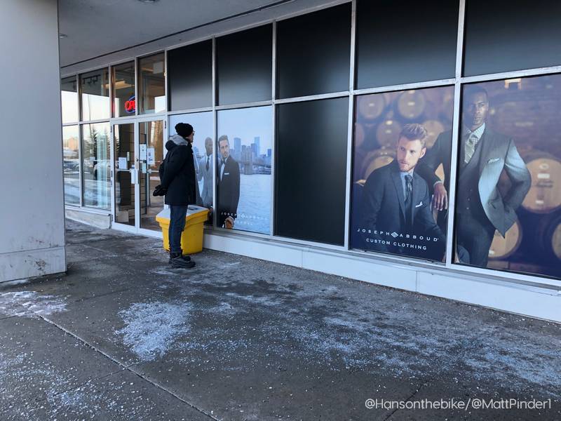
Matt: Though the mall is barely 25 years old, it seems to have passed its peak. Several stores are gone, such as Roots and Globo to name but a few. If you look at the GeoOttawa aerial photos, you’ll notice the parking lots are never even ⅔ full. Still, the mall does contain many valued amenities for the area – the Walmart and Loblaws are always busy and draw people from a pretty large distance.
Hans: Yes, speaking of which, the brochure on the mall’s website tells us that there are approximately 130,000 people living within 1 kilometer of the mall. But I don’t believe that. That would mean that 1/8th of Ottawa lives within a kilometer of the mall. There is no way that that is correct.
Matt: Your hunch is correct – the 130,000 people are within 5km of the mall. Still, this is a substantial population to be within just a 20 minute bike ride of South Keys.
Isolated Place
Hans: If I look on a map, the mall at South Keys is really a somewhat isolated place. It is separated from the community by busy roads and it is not a great place to walk to at all. It is hemmed in by the Airport Parkway, the Trillium Line and the Transitway, Hunt Club Rd and Bank street and I find it quite hostile to pedestrians. Its slogan is: “A premiere shopping destination in the heart of Ottawa”. Isn’t that a bit pretentious?
Matt: I tend to agree, but I don’t want to undersell it either. Maybe we can agree on a revised slogan for its future, how about “Ottawa’s premiere transit-oriented community, a short train ride from downtown, the airport, Carleton University, and much more”?
Hans: That is a lot of text to put on a T-shirt. Having lived here for a while now, and being a driver as well as a pedestrian and a cyclist, what is your opinion of the area, being a traffic engineer?
Matt: Though I don’t have the same tenure here as many of my neighbours, I have indeed travelled around the neighbourhood by foot, bike, car, and transit. In fact, for the first 9 months my partner and I lived here we did not own a car, instead relying on a car rental place just a five minute walk from our door when we needed one. Eventually we did realize that life in the suburbs is challenging without a car and we bought one, but the experience has given me a lot of perspective.
Hans: Our car cost us 60 cents per kilometer, when you factor in tires, taxes, depreciation, insurance, repairs and gas. I wrote about it in this post about the concept of “MAAS”.
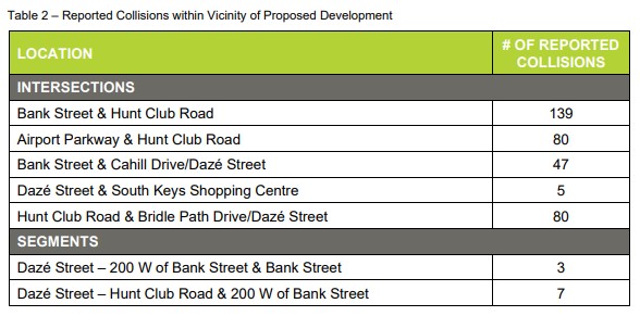
Matt: As you mentioned earlier, South Keys Centre is an island surrounded by high-speed traffic and two rail corridors. From 2015 to 2019, in five years time, there were 361 collisions in the immediate area. While walking in the neighbourhood is very pleasant, a trip to the centre requires crossing these roads at wide, noisy intersections with very long signal cycles. When we walk for recreation, we never cross Bank Street, even though it’s right behind our house – doing so always feels like a chore.
Changes Coming
Hans: But apparently, big changes are coming. A few years ago I talked to a city planner, and he told me that the Train Yards was probably the last mall that was built the way it was built in Ottawa. There is a secondary plan for South Keys and it is going to look very different. I believe the mall owners have also indicated changes are coming. The mall is now 25 years old and it is mostly a mega parking lot. Not a great use of land near two LRT stations and an airport I gather and not integrated in the urban fabric. As a resident, I am sure you can fill us in with more detail about upcoming changes.
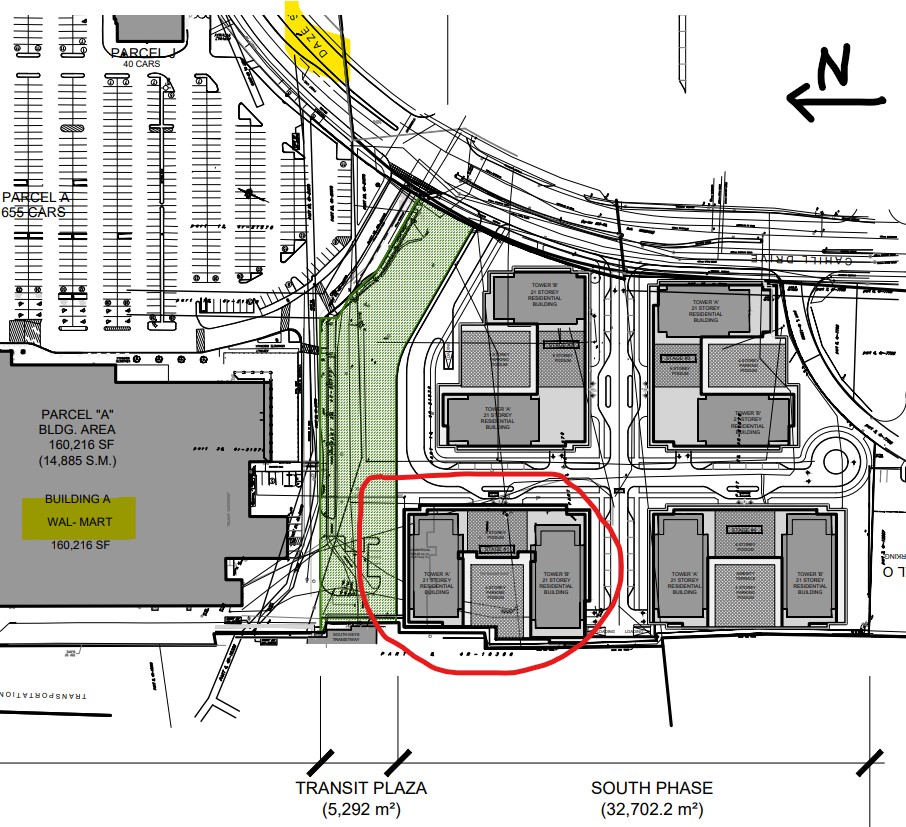
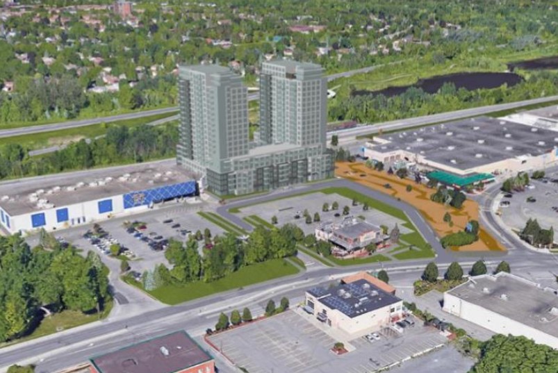
Matt: The potential of this area is staggering, and is the reason why I’ve formed a new group called Better South Keys Centre, a community coalition advocating for the enhancement of South Keys Centre. The City’s plans include towers up to 21 storeys, mixed-use development, active transportation infrastructure, protection of green space, and everything else you would expect for a complete community. What’s needed now is some near-term efforts to begin moving the needle towards that future. While many residents are excited about these changes, others are concerned and we need to be able to show people that adding density and amenities is something that can benefit the neighbourhood. We’ve seen good plans fall through many times in Ottawa and elsewhere, and I hope to be a part of making sure that doesn’t happen here.
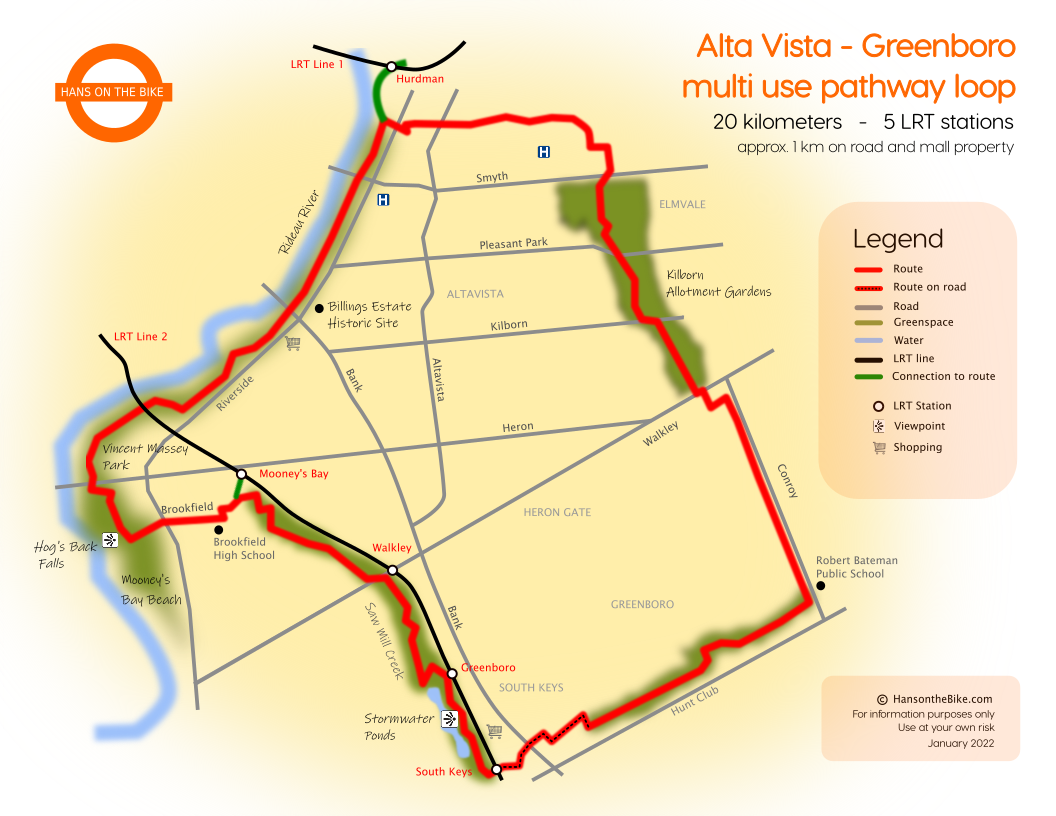
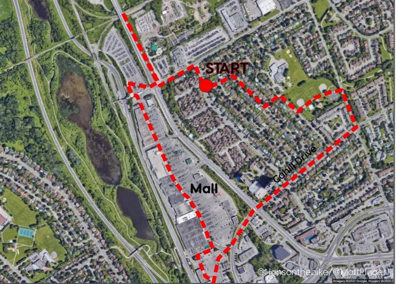
Hans: Once in a while I cycle to South Keys from Nepean. There is bike infrastructure nearly all the way, and the Saw Mill Creek is a big part of my route. But once I am at the east side of the South Keys station, I can’t find any cycling infrastructure. I find that disappointing. With another station coming at the top end of the mall, what type of active transportation can we expect? Are there any investments planned in AT in relation to the new transit stations?
Cycling is the Low-Hanging Fruit
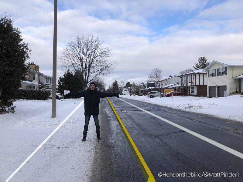
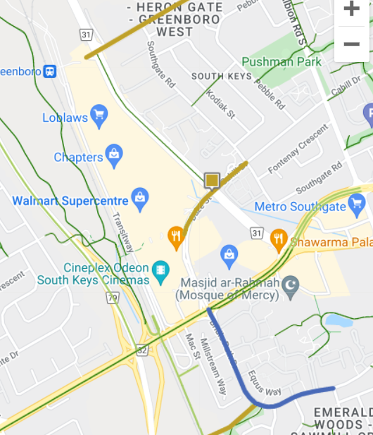
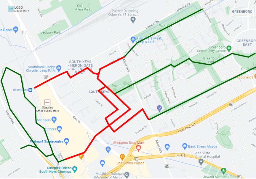
Matt: As I mentioned earlier, one of the City’s biggest “low-hanging fruits” for new cycling infrastructure in Ottawa is to connect the Greenboro Pathway to South Keys Centre. I was pleased to see a segment of this included in the draft active transportation plan put out for consultation in December. The proposed plan includes cycling facilities on Cahill/Dazé from Southgate Road, across Bank, and to the Walmart entrance.
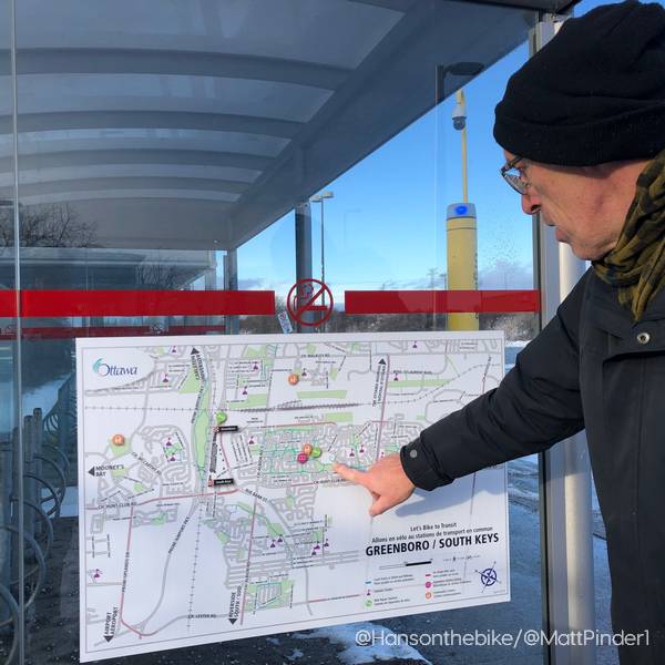
Hans: I think it is really important that a lot of thought should go into the ground level of the building (Home – The City at Eye Level). What happens at the ground level, retail, restaurants etc is important for the vitality of a road, but with online shopping increasing, I can see it is hard to make that work. Therefore pedestrian and cycling traffic (“eyes on the street”) is so important for a city as we learned from Jane Jacobs. Do you think the current proposals are sufficient for active transportation? I am going to guess you would love to bike to the station properly eventually and I am going to shamelessly plug my latest map here:
Focus on Local Cycling Connections
Matt: I’d like to see the plan improved further. To really maximize its value the connection should be all-ages-and-abilities friendly, to the point where a parent would be comfortable letting their 12-year-old cycle to South Keys Centre unaccompanied (a concept I’m sure you’re very familiar with as a Dutchman). To do that, we need physically separated infrastructure across the entire length and a protected intersection crossing Bank Street. It’s an incredible opportunity to connect the 20,000+ residents already served by the Greenboro Pathway to amenities, transit, and other regional cycling infrastructure. For people like yourself, it’s an opportunity to make it easier for visitors to Greenboro to arrive by bicycle, or to simply travel through and enjoy the pathways.

Hans: Yes, you hit the nail on the head here. Municipalities often focus on creating corridors through their towns or cities, with many kilometers on shoulders or on-street bike lanes to create ‘safe cycling’. But if you really want cycling to happen, you have to build safe separate community connections to malls, schools, churches, community centres, coffee shops, restaurants and -dare I mention it- hospitals. As you can see above in the sketch, this is missing. Talking about coffee, I think it is time for a hot chocolate. Any funky independent place here?
Matt: Well we do have one of those small, independent cafés people have been talking about lately – I think it’s called… Starbucks? Jokes aside, just about all retail in the South Keys Mall is chain stores. Though there are more independent businesses as you get farther away, I think we’re going to have to settle for a chain café today. Let’s grab some hot chocolates to-go so we can warm up a bit.
Hans: Great idea. I am going to add whipped cream.
Think Big for Bicycle Parking
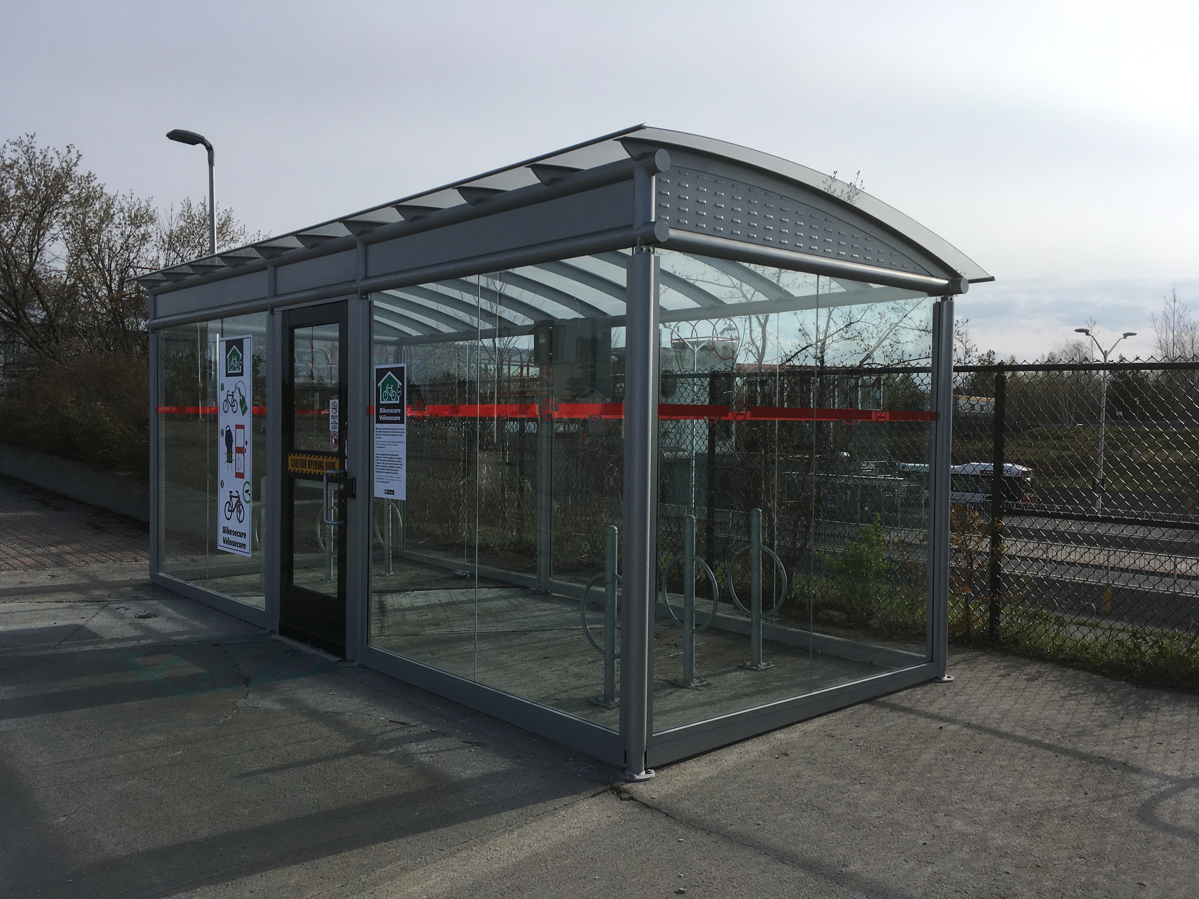
Hans: Let’s walk north to Greenboro O-Train station. Not only do we have a vast parking lot here, there is even more space for parking at the current Trillium line transit station. And I noticed a bike locker for no less than 12 bikes! That isn’t very generous, is it?

Matt: While I am glad to see the City and OC Transpo showing an interest in secure bike parking, I must ask the question: “what problem has this solved?” Secure bike parking in such small quantities doesn’t accommodate cycling en masse, it only serves the needs of a few people. Would we ever build a park-and-ride for drivers that includes just 12 spaces? Of course not, it wouldn’t be worth the effort. Secure bike parking is a wonderful solution for improving access to transit but it needs to be done at scale. Several Montreal commuter rail stations have been getting bike rooms holding 50+ bikes and they’ve been wildly popular. I’d much rather see Ottawa start by building a few large bike rooms (50+ bikes) than scattering several dozen of these tiny ones across the network.

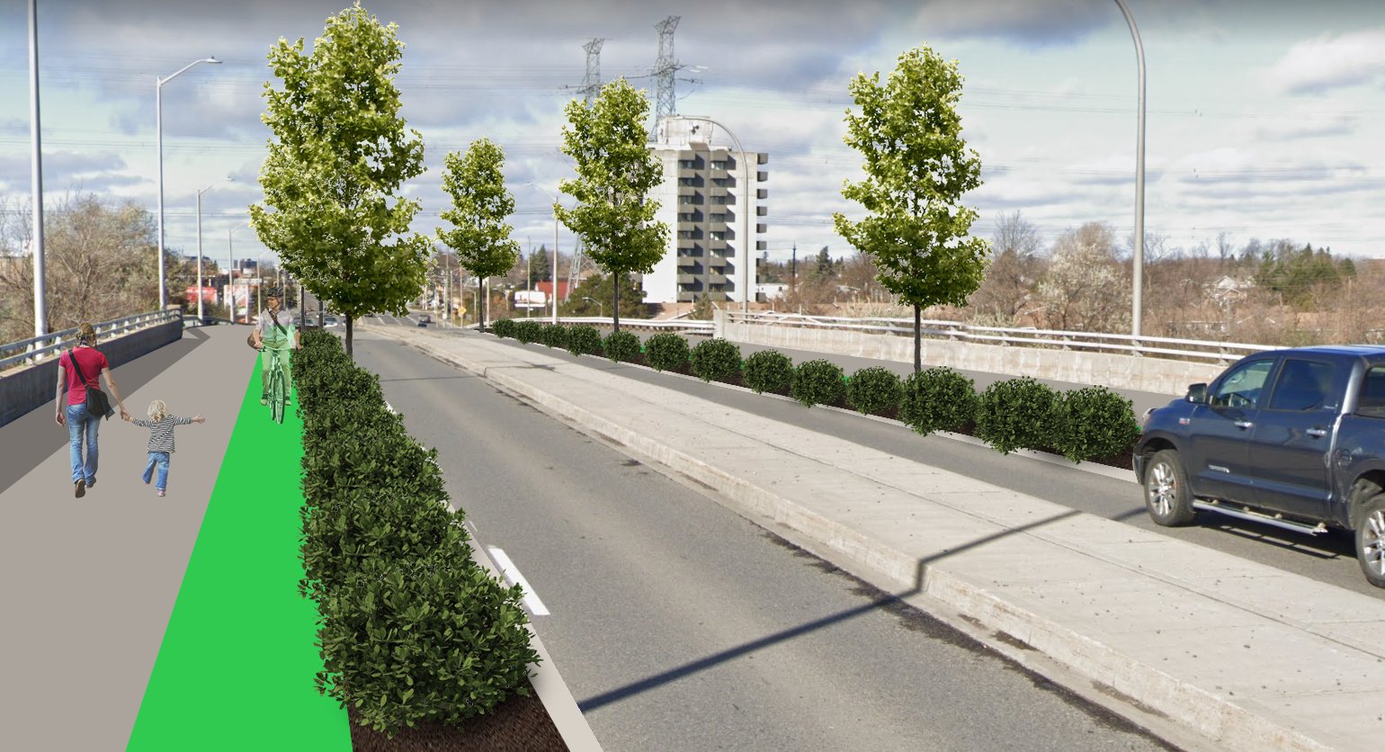
Matt’s Road Diet Idea for Bank Street Bridge
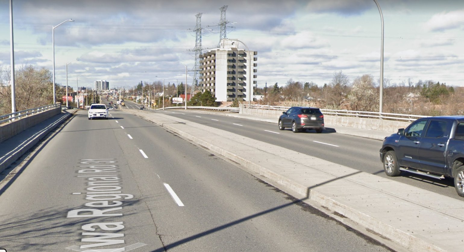
Matt: We’re just about done with our tour. One of the last places I’d like to take you is over the Bank Street bridge across the rail tracks. What do you think?
Hans: It is actually kind of scary walking here with traffic and OC Transpo buses coming from behind you. It is not inviting to walk here, the sidewalk is clearly an afterthought. But I sense you have a plan for this bridge.

Matt: There’s a lot about the neighbourhood that I like but crossing this bridge on foot is something that could use some major improvement. By car, the bridge feels like nothing – an easy chance to easily cross between two places. By foot or by bike, crossing the bridge is noisy and dangerous as you walk right next to traffic regularly going 70km/h or more. Here’s a light post that was knocked over a few weeks ago when a driver ran off the road and swerved into it. I’m glad there wasn’t anyone on the sidewalk here at the time.

I’d like to see some efforts in the next few years to pilot a “road diet” over this bridge to one lane in each direction with separated bike lanes. It’s tough because of the large amount of vehicle traffic that crosses this bridge, but with the airport parkway being widened just west of here, my sense is that “just enough” traffic could actually shift to that route that a diet here would not create the gridlock that some might fear. Many people would have thought a two-lane Bank Street bridge through the Glebe was impossible a couple of years ago, and yet now the City wants to study something similar on the Bank bridge over the Rideau River just north of here.

Hans: Looking at South Bank Dodge and Artistic Landscaping from here, they are sitting on enormously valuable lots totaling about 25 acres. That is huge. I can see lots of potential for housing, across the street from an LRT station. Are there any plans for that land in the secondary plan? A dozen 21 storey towers perhaps? And how would that best integrate with busy Bank St running between the station and the community?
Matt: A vast area indeed! To be honest this is not an area I have focused much attention on, but reading into the City’s plans now it appears they are going to conduct a land use study for this area at a future date. Today it’s zoned for industrial, but this site could very well become more mixed-use development given its very close proximity to Greenboro station.
Hans: We both wrote blog posts about South Keys before, here and here. We both believe there is huge potential here, but somewhat ironically, as there are no homes yet, there are no residents to monitor what should happen here. Any ideas how to deal with that?
Better South Keys Centre Group
Matt: There are several community associations in the area that are well-established and certainly interested in the evolution of South Keys Centre, but to your point, no existing residents there to consult with. This has been another reason for my forming of the Better South Keys Centre group – we hope to advocate for the needs of future residents, while helping shape development in a way that also benefits the surrounding neighbourhoods. I’m excited to see how this model works! If it is successful it could become useful for other areas that are primarily non-residential like the Trainyards or Lincoln Fields.
Hans: Well, this was the end of our walk. Thank you so much for inviting me. With LRT and the Transitway both stopping here and an airport around the corner, I might even consider moving to a condo here. I just hope they won’t only build one bedroom bachelors, but more 1000-1200 ft2 condos and apartments, so I can live a car free life in a walkable area. And you can drop by with your kids and leave your car at home!
Matt: It would be a dream come true if one day 10 years from now my family and I could join you for a walk down the new South Keys Main Street together and enjoy the new density and walkable amenities. Let’s put it in the calendars!
Matt Pinder is an engineer who designs streets for people and the author of the blog Beyond the Automobile. He lives in Ottawa’s South Keys neighbourhood, recently took an interest in development plans for the area, and started the Better South Keys Centre group.
Hans Moor is the author of the blog HansontheBike.com. Hans served as the President of Bike Ottawa for a number of years and worked with councillor Egli and others on safer cycling infrastructure to bypass Merivale Rd, resulting in the Nepean Trail. During his time at the Dutch embassy, he was regularly invited to speak about cycling in the Netherlands. For his cycling advocacy efforts he received a medal from the Governor General of Canada. He recently discovered he’s a distant cousin of Vincent Van Gogh.
Sources:
- Mall brochure December 2021
- Wikipedia
- City of Ottawa: South Keys – Blossom Park – Bank St secondary plan
- Overview of building heights: South Keys to Blossom Park, Bank Street Secondary Plan Schedule C – Mixed-Use Area Permitted Building Heights (ottawa.ca) (12, 15 and 21 stories)
- Smart Centres site plan proposal: Application Details – Development Applications Search (ottawa.ca)


As a mall buff I found the last two articles very interesting. Always thought it was funny that South Keys used Premiere instead of the correct spelling of Premier.
LikeLike
Thanks for putting time into this boys. Would like to see more of this stuff for sure for Greenboro. It is srsly in need of a renovation
LikeLike