

Matt and Hans met up on a pleasant August morning to cycle Ottawa’s Scott Street, which was recently upgraded with separate bike tracks, Dutch style intersections, cross rides and on-demand push buttons for cyclists with feed back lights.
Introduction
Matt: Nice to catch up with you again, Hans! It’s been a little while now since our Merivale and South Keys walks. I’m looking forward to cycling the Scott Street cycle tracks with you. This project has been in the works for a while now, and with the massive project underway to extend Ottawa’s LRT network westward, it’s finally come to fruition.
Hans: Improved bike infrastructure on Scott has been on the wish list for a long time. The new tracks run parallel along the yet-to-be-opened Stage 2 of LRT and it would be interesting to see what Ottawa has built. I know there are several new protected intersections in the new design. Although we have a number of those intersections already, I’d like to see how it panned out on Scott.
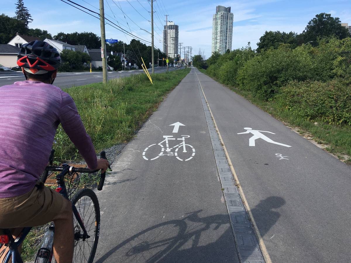
Matt: Last time I rode Scott Street, there was a nice multi-use pathway (MUP) along the north side that carried bikes in both directions and pedestrians. I wasn’t really aware of any issues with the design and it seemed to work pretty well (at least from my two-wheeled perspective). It seemed to be a comfortable route even for people to cycle with their children. Any idea why this was changed?
Hans: I agree, the few times that I cycled there, the MUP was pleasant to cycle, with few interruptions as it ran along a trench with a bus rapid system, locally known as the Transitway. The trench used to accommodate the Canada Central Railway and served as a rail track until 1982. In a few years it will accomodate Light Rail. My guess is the city knows it will be busier on the pathways feeding into LRT stations with LRT Stage 2 opening eventually and wants to separate pedestrians from cyclists.
With bidirectional pathways, there is always the issue that if you turn as a driver, you have to expect bike traffic from both sides and not everyone knows that. It is more common to have bike traffic in a lane on your right only in an urban setting. So having two systems might confuse the already distracted driver…Of course, you could solve that with proper light cycles, where drivers don’t interfere when cyclists and pedestrians crossing side streets.
What do you think of this?
Matt: There’s certainly trade-offs; two-way bike crossings have been found to cause more bike-car collisions than one-way crossings. Still though, Scott Street is unique in that there are far more conflict points along the south side than the north. For example, between Churchill Avenue and Island Park Drive, there are just 2 vehicle interaction points on the north side, compared to 11 on the south side (including driveways). So planners and engineers had to decide, is it better to have a small number of less safe crossings, or a greater number of more safe crossings? It’s never so black-and-white.
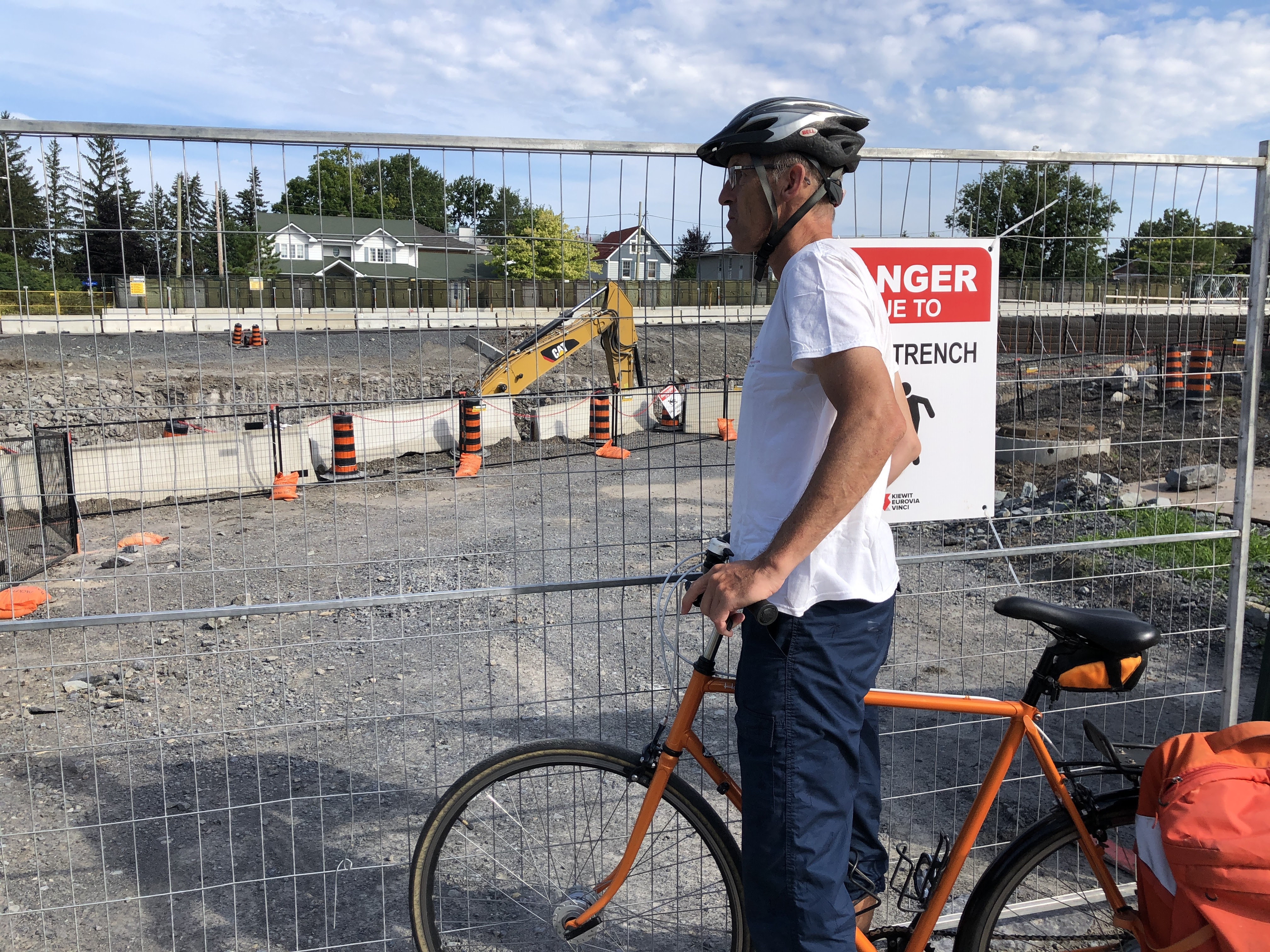
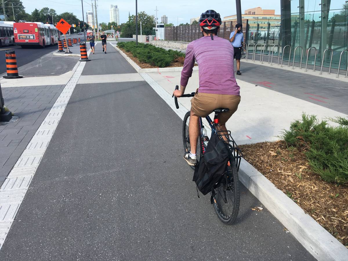
Hans: Let’s get going on our ride here from Tunney’s Pasture LRT and head westbound and check out some of the details. Scott Street runs from Churchill Ave in the west to Bayview in the east where it becomes Albert St and continues toward downtown. The entirety of the Scott-Albert segment planned for upgraded bike lanes is 4.5 km (2.8 miles) long, and the completed piece we’re riding today is 2 km (1.2 miles). Interestingly, Churchill Ave was the first Complete Street in Ottawa back in 2014 and likely the first example of cycle tracks built in Ontario.

I thought I read a few weeks ago that the paths were officially open, but it still feels very much like a work in progress. This first part was a bidirectional MUP and clearly still being worked on. I am sure we’ll see a lot more landscaping, as it looks pretty messy still. While cycling here and seeing some great improvements and some unfinished parts, I keep getting that theme of Ennio Morricone’s movie “The Good, the Bad and the Ugly” in my head.

Matt: Well, there’s our blog title! Let’s just switch the order because I’d much prefer to end on a high note.
The “Ugly”
Matt: Let’s not dwell too much on the “ugly” parts of Scott Street, as there’s plenty of discussion already about that on Twitter, but Hans, we simply must discuss the notorious pool noodles. For those unfamiliar, there’s one point on the new cycle tracks where a pair of signs were added on each side of the cycle track along a curve, creating an almost impassable pinch point and certainly a hazard. Pool noodles quickly appeared on each signpost, and shortly after, one sign was removed. But here we still have one sign with a noodle!
Hans: I am known for my anti sign crusade, I am more in the camp of letting people take responsibility and figure things out. That will cause them to be more cautious. The pool noodles are obviously an indication that these details are not always thought through though.
Matt: Just one other “ugly” I want to mention: curbs. Specifically where cyclists have to cross between the cycle tracks and the roadway, there’s always a curb separating the two, and many of them are not flush.
Hans: It irritates me to no end that we have those curbs at a bike lane when you cross a street. Everytime you hit that curb, even when it is just a few cm, you feel it in your bum, your wrists and everything on your bike rattles. I saw a similar mistake on Laurier at Bay downtown, the curb comes up halfway the track entrance, so part of the lane entrance is 2-3 inches high already. Plain dangerous.
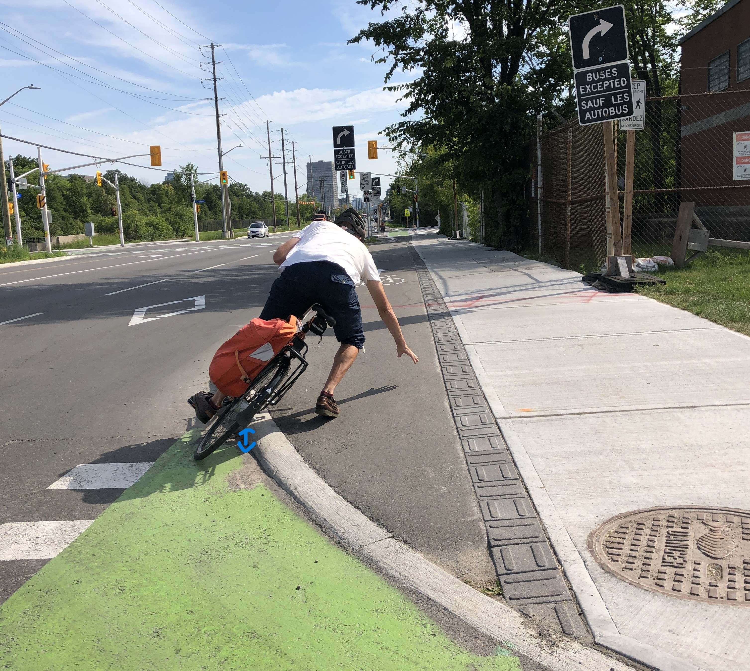
Why can that not be just smooth riding; why do we need a curb across a bike path in the first place?
Matt: There’s really two solutions to this. The most effective is to simply not provide curbs across the bike paths, ensuring a smooth path of travel that is continuous on asphalt surfaces. I know this is now the City’s preference, and it’s been laid out that way in Ottawa’s award-winning Protected Intersection Design Guide. The second solution (which is more of a band-aid) is to make sure that where curbs are used, a smoother curb type is selected and the contractor builds them correctly. I know that the City of Toronto’s protected intersection designs include cyclists crossing curbs, but that a different type of curb is used that provides a smoother transition.
Hans: OK, here is one for the road (pardon the pun):

Matt: Sigh!
The “Bad”
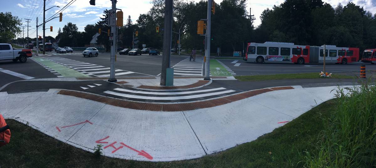
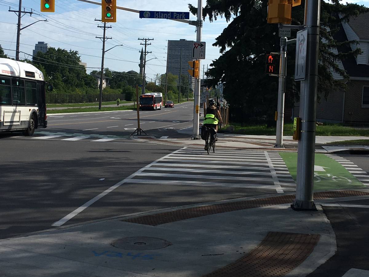
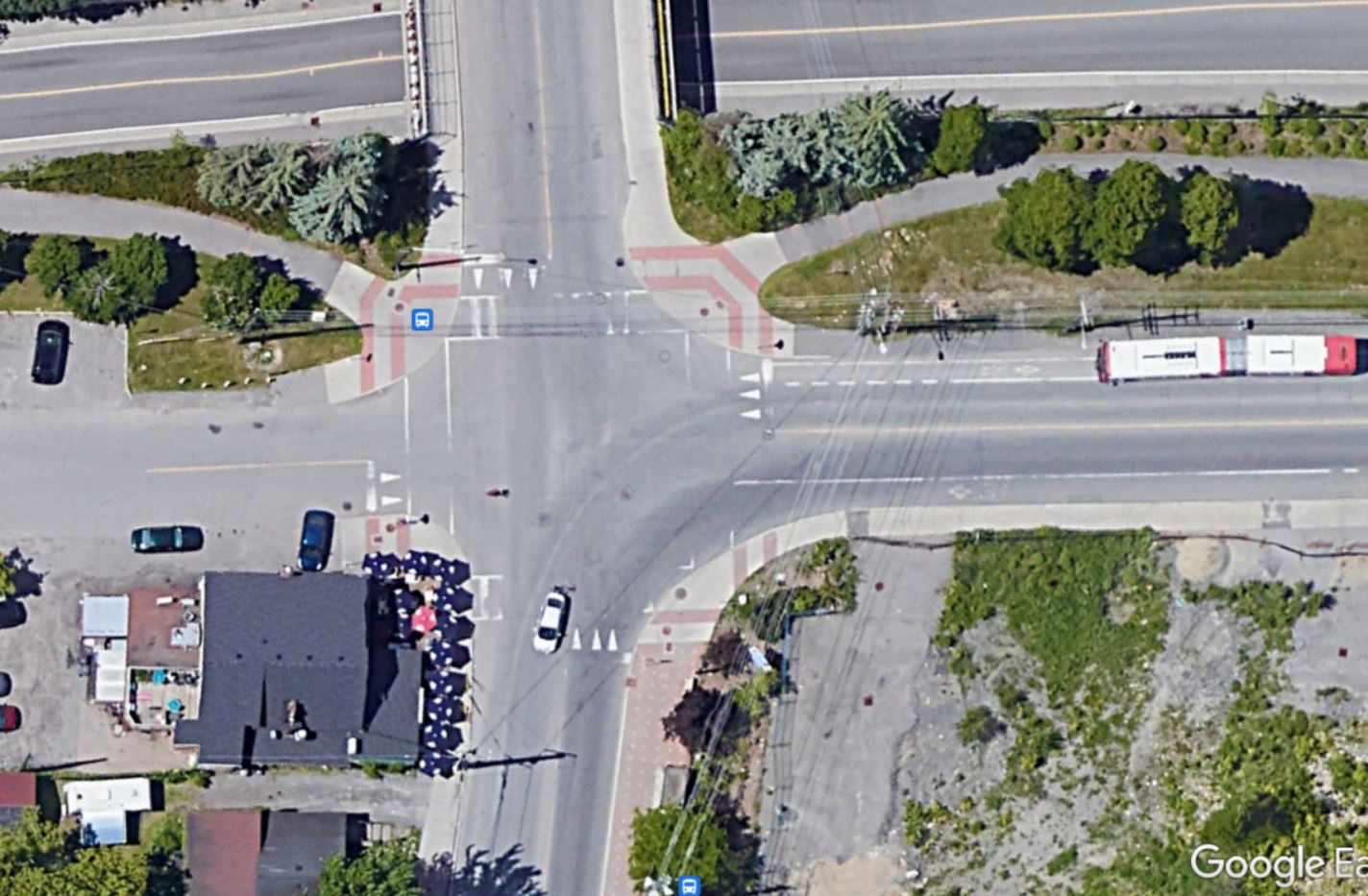
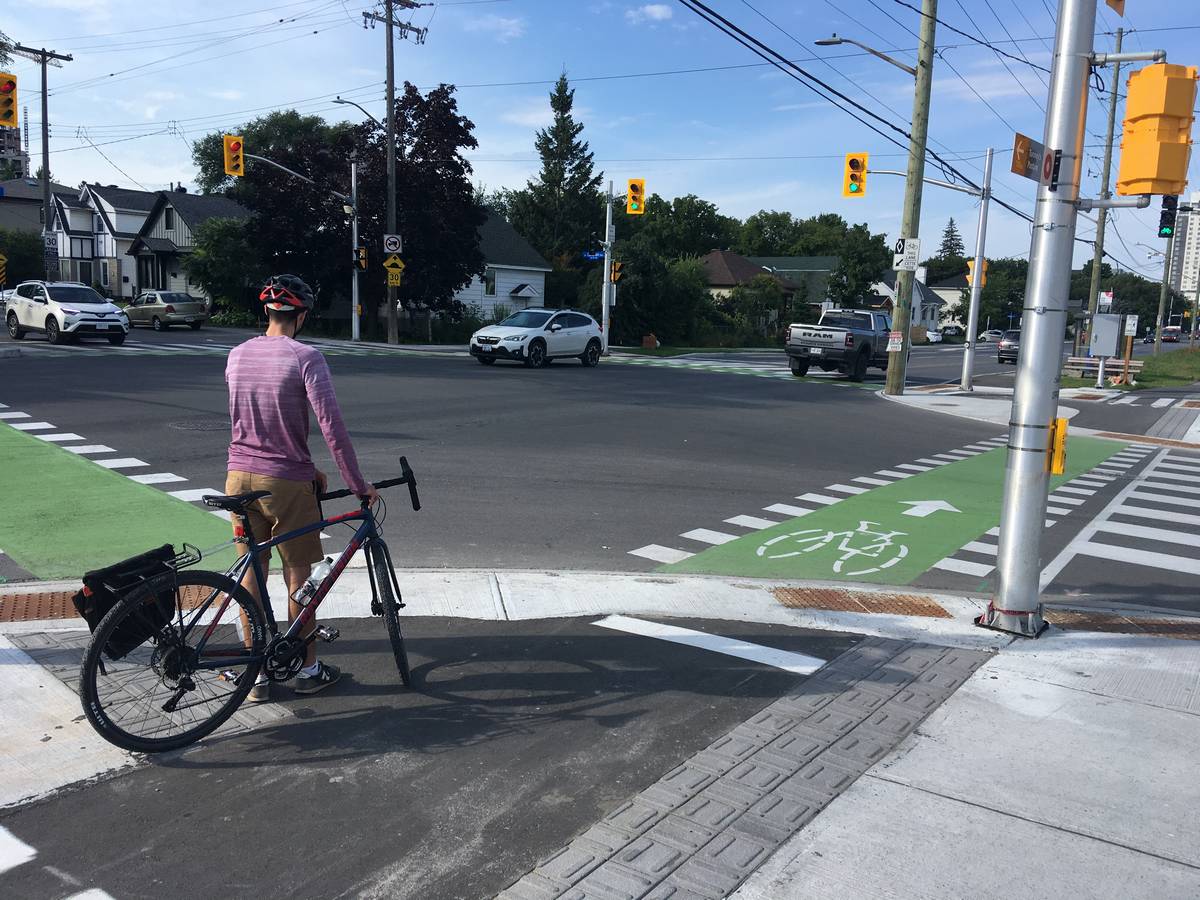
Matt: I’m glad we got the ugly parts out of the way and fortunately those can be solved easily. Still, there are some less-than-ideal parts of the design that we can have some constructive discussion about. First let’s talk about the “reverse protected” intersection at Scott Street and Island Park Drive.
Hans: I noticed something strange about the design when we cycled through there. For one I noticed the bike lane is on the outside and the crosswalk on the inside. As you can see in the photo, I think that is not a smart design as cyclists simply go straight, intentional or not. The desire line is too far north I think.
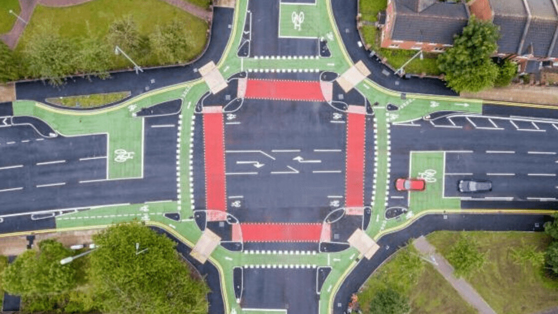
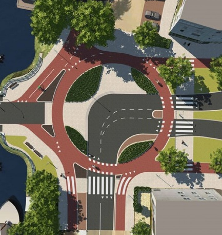
Matt: The design is inspired by the “cyclops” junction (Cycle Optimised Protected Signal) layout first developed in the UK.
Hans: A cyclops ¯\_(ツ)_/¯ ?
Matt: A cyclops (Cycle Optimised Protected Signal) is like a protected intersection except that it flips the bike and pedestrian crossings.
Hans: So, a “reverse protected” intersection?
Matt: Indeed. In the UK, it is law that pedestrians and motorists are not allowed to be given green signals at the same time if their paths conflict, which is of course very different from here. By my count, this is Ottawa’s second “reverse protected” intersection (the other one being at Bronson Avenue and Sunnyside Drive).
Hans: OK, so let’s discuss if it works here at Island Park.
Matt: I’ve been curious as to how this layout would work in reality, having seen a few designs come across my desk. I have two main criticisms: first, the sharp bend-out of the bike path makes it very hard for a through-bound cyclist to see and be visible to a right-turning motorist (which is not a problem in the UK design where signalized conflicts are not allowed); and second, the flipped layout means that cyclists are led straight into the crosswalk and have to swerve to use the correct crossing. Standing here for just a few minutes, it’s clear that most cyclists are using the crosswalk, which will lead to more conflicts with pedestrians.
Anything else you’d like to add to the “bad” category, Hans?
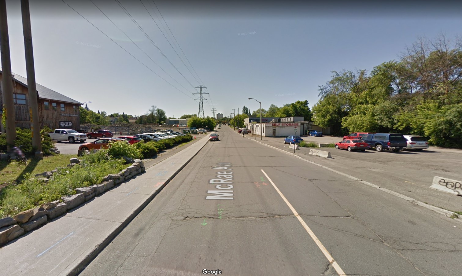
Hans: Something that caught my eye is the size of the corners at the intersection of Scott Street and McRae. Looking at the corner here, I noticed the corner radius appears to have radically increased. Why is that Matt?

Matt: One of the oddities of Scott Street is that even though it’s a relatively low-traffic two-lane road, it’s also classified as a truck route, which by Ottawa’s standards means that a full-sized transport truck needs to be able to navigate it. McRae is also a truck route, hence this truly massive corner radius, built for the handful of trucks a day servicing the grocery store and car dealership. The “cost” of accommodating this infrequent large vehicle here is very clear: a much longer pedestrian and bicycle crossing with large radii that will encourage drivers to take the corner much more quickly than they should.
Hans: Scott ends (or starts) at Churchill, which is an interesting road on its own as it got a diet in 2014 already, the first one so in Ottawa. Unfortunately, the Churchill bike tracks don’t connect with Scott (yet?). This is a huge intersection for relatively little traffic. I am sure you would have designed this differently.
Matt: Another victim of the truck route designation! This intersection is not that busy and actually used to just be a four-way stop. With the transitway temporarily detouring through here while the LRT gets built, there was a need to improve its capacity for all the buses. This meant adding a traffic signal and extra turn lanes, and the south-east corner needed to be updated to allow the rare transport truck to make the corner. If I had full reign over the design of this intersection I would have drawn inspiration from the Dutch and designed it as a curved roadway where traffic flows smoothly from Churchill right onto Scott, and the other two legs function more as driveways. This would need less space, lead to less delay for all users, and cost less to build and maintain.
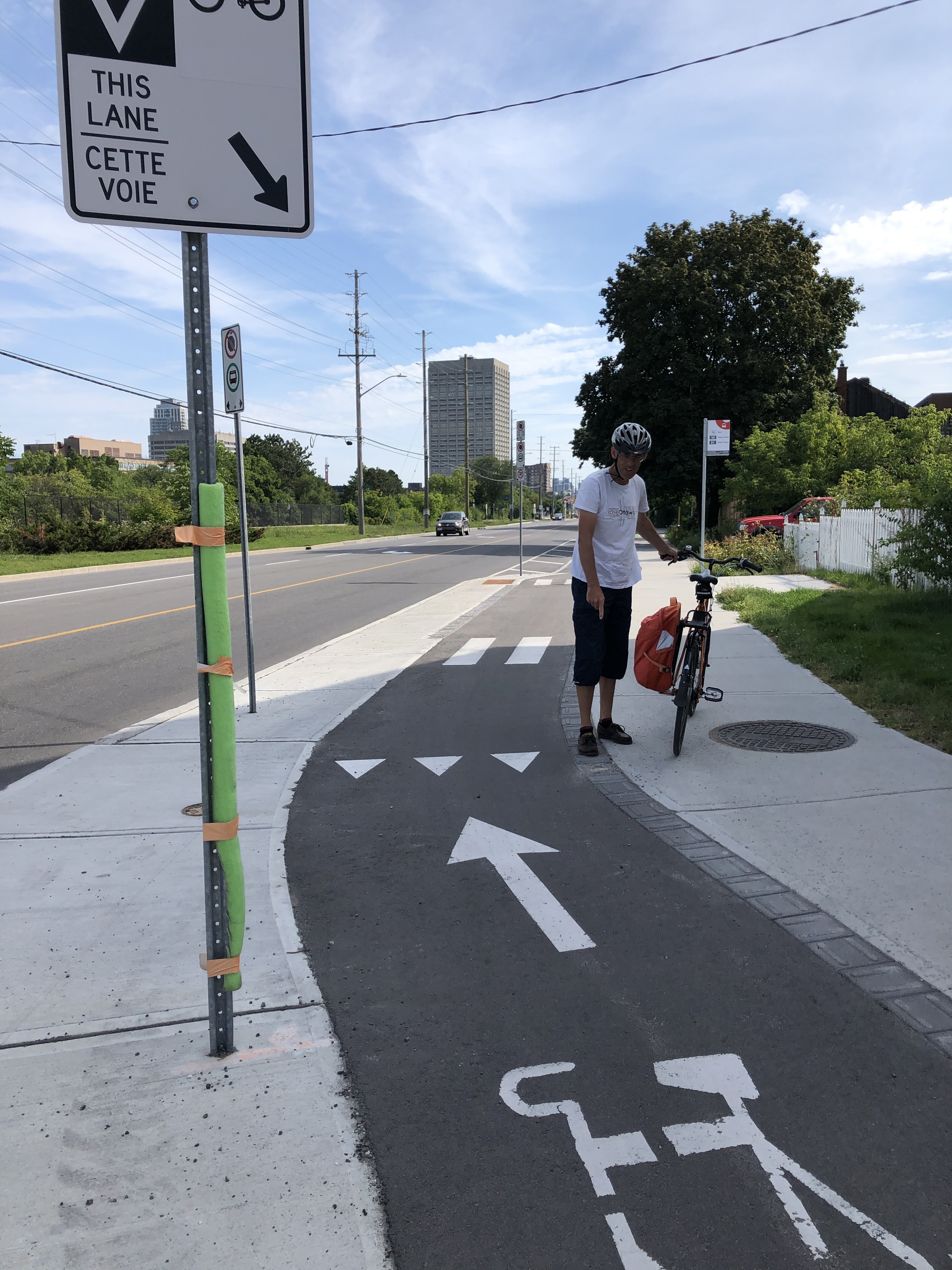
Matt: I was not at all surprised to see that you brought your measuring tape, Hans. Tell me why you stopped to measure the width of the cycle track here and what you found.
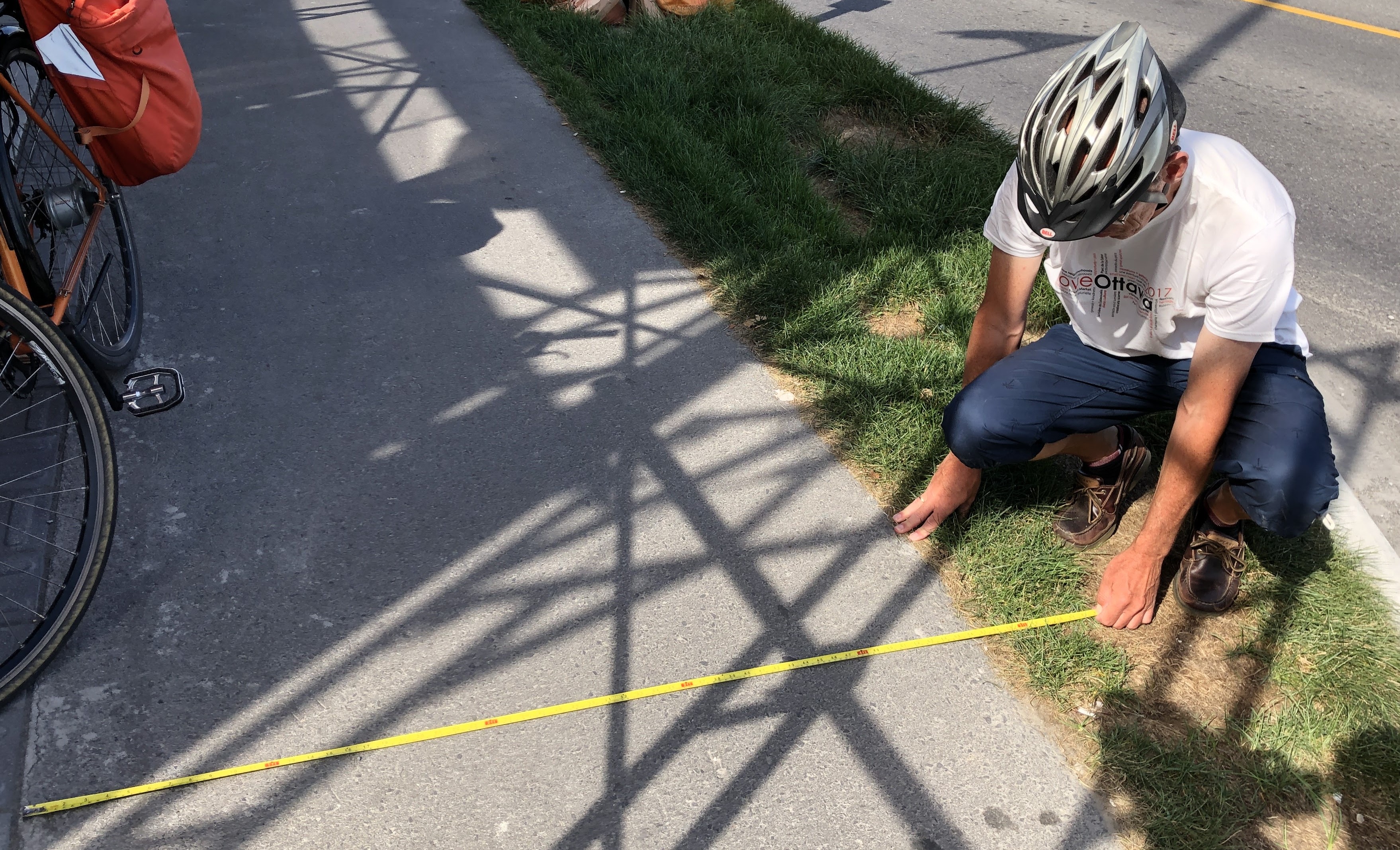
Hans: Just to be clear, I don’t always cycle around with a measuring tape. I am fortunate that my foot is actually exactly a foot, so whenever I want to measure something flat I can measure it. But I had noticed before that some stretches feel very narrow. Signs close to the lane make it even more claustrophobic. I thought I measured this particular section properly and it is under 5 ft, which I believe is below the standard. It is minimal here.
The “Beautiful”
Matt: Ah, finally we can talk about the Beautiful.
Hans: As typical residents cycling around town, we always find first the stuff that we think doesn’t work. But we should recognise that building out nearly 9 km of bike tracks (4.5 km each way) through an older part of the city has its challenges. In an ideal situation, the entire road would have shifted more north, to allow for more cycling space on the south side. But these decisions are trade offs. Is it worth spending extra millions to change the entire road or use that money for bike infrastructure somewhere else?
Matt: I agree! I work with some communities who are still just deciding whether protected bike lanes are a good idea. In this regard, Ottawa is light-years ahead of most of North America (something you emphasized in your recent post about rankings). Scott Street is the culmination of years of experimentation with new designs in Ottawa and there is a lot to like along here. For one, aside from the Island Park Drive oddity, there are several other “regular” protected intersections just built along the corridor. For you and me, these are old news now, but tell me how you felt riding through those, Hans.
Hans: I am fine in all kinds of traffic but I am definitely noticing I am more relaxed on separated tracks. I recently cycled the new tracks with my wife on a Saturday afternoon and we zipped through all the intersections at the south side, heading east, despite the many side roads. It was really a great experience. In my early teens, three friends and I would bike to high school in the Netherlands on a narrow dyke, with tractor trailers with flowers and vegetables passing us. Three feet on our right was a canal. It.was.scary. We were afraid. On bike tracks, life is so much more relaxed, despite pool noodle clad signs and side streets and uneven curbs.
Matt: Though it’s not a feature of the street specifically, let’s talk about all these towers popping up along the corridor.
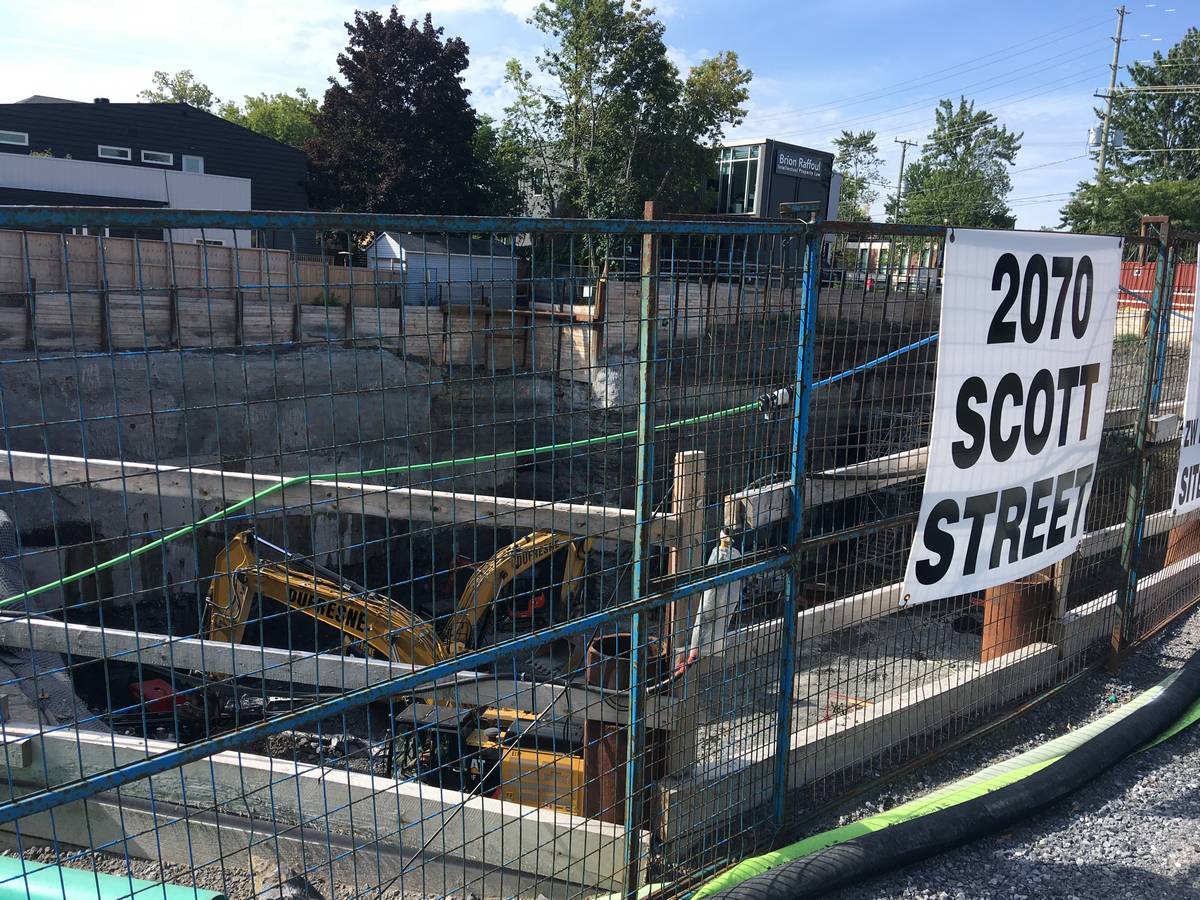
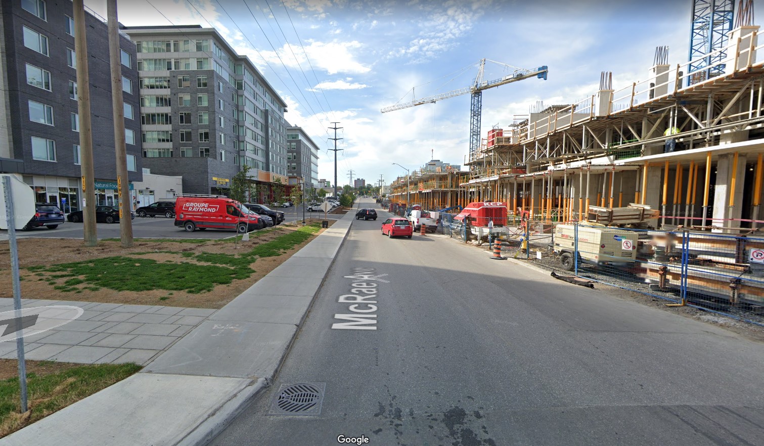
Hans: Last year I read a remark online by a real estate person, who mentioned that properties along the (future) LRT are going up in price faster than elsewhere. I guess that is an indication that people really want to live near transit. No doubt there is real estate speculation in there as well though. I hadn’t been here much the last few years and I was surprised there is so much construction going on along Scott. I remember there was the lone Trailhead store with a parking lot on Scott and McRae and now there is this enormous tower.
Matt: I’m so excited to see higher density housing being built right next to high-quality transit and a people-friendly streetscape. While Merivale Road is undergoing a lot of densification, the transit plans there are still lacking. In the case of Scott Street, many of these new towers will finish as the LRT is completed, and all new residents will have access to exceptional cycling facilities. Building off this, I really hope in the coming years our politicians will have the courage to end the single-family zoning that is still pervasive on the side streets just off of Scott Street.
Hans: But to be honest, I wouldn’t appreciate a 6 storey building next to me when I just bought a home in a side street.
Matt: A good point. Ending single-family zoning doesn’t mean allowing towers of infinite height everywhere. More suitable would be allowing “missing middle” density, where a pair of homes could be replaced with, for example, a three-storey building with 12 townhouses and maybe even a small business like a cafe. This is the type of density you find on residential streets in Centretown already.
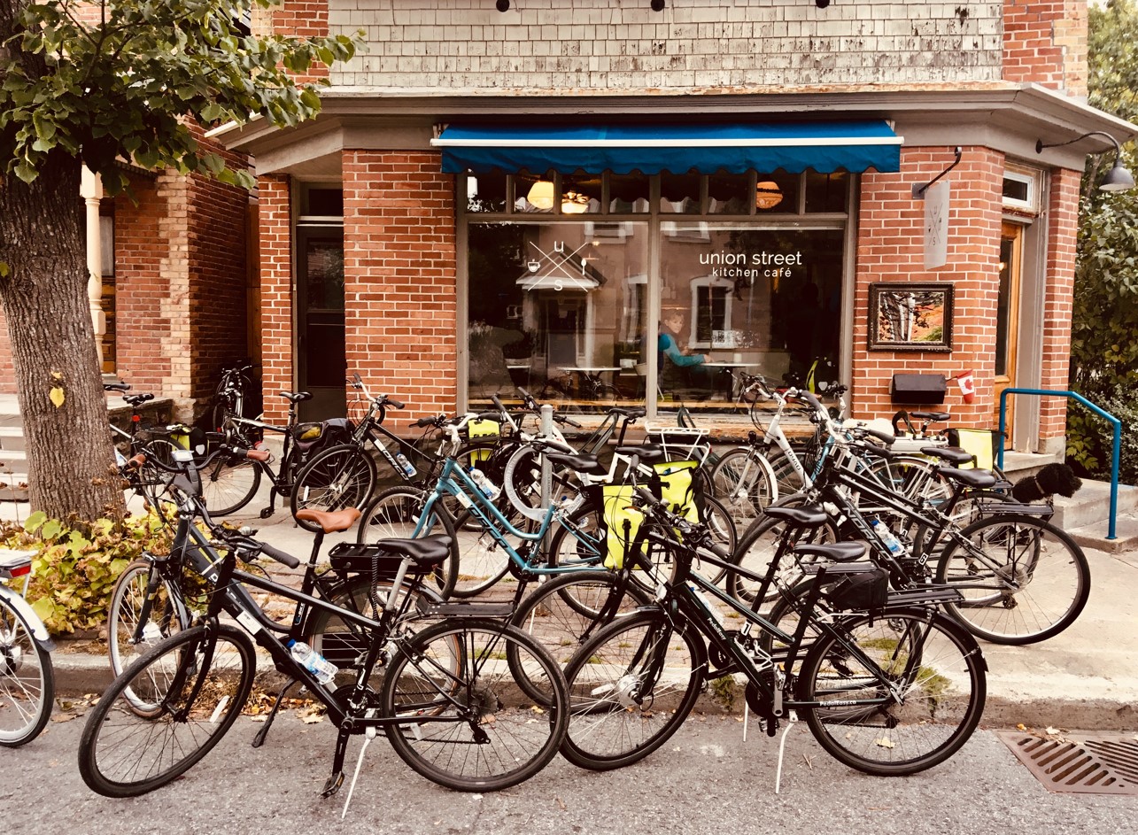
Hans: Like that corner cafe in New Edinburgh, at the intersection of Union and Crichton. That seems to work well.
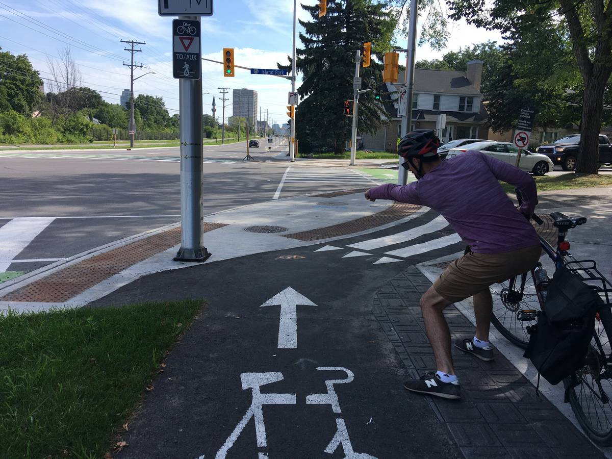
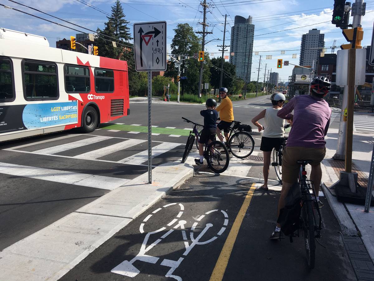
Matt: Speaking of intersections, there’s another new feature at some intersections that I know you quite enjoyed, Hans. Seriously, you looked like a kid in a candy store when you used them. What are you visualizing there?
Hans: For the first time, in addition to the “three yellow dots”, and the detectors high up on a pole that react to body heat, cyclists at some intersections can now press a button to call the signal. And not only that, it actually has a feedback light. I believe this is a first in Ottawa. Ideally, we would have those wonderful Dutch feedback LED (clip on YouTube) lights that count down, so you know how long you have to wait. We have seen several pedestrians and a cyclist crossing Scott in places where they shouldn’t for their safety, which is an indicator that waiting times are too long. The traffic systems don’t appear to have sensors that can regulate traffic based on supply of traffic in different directions.
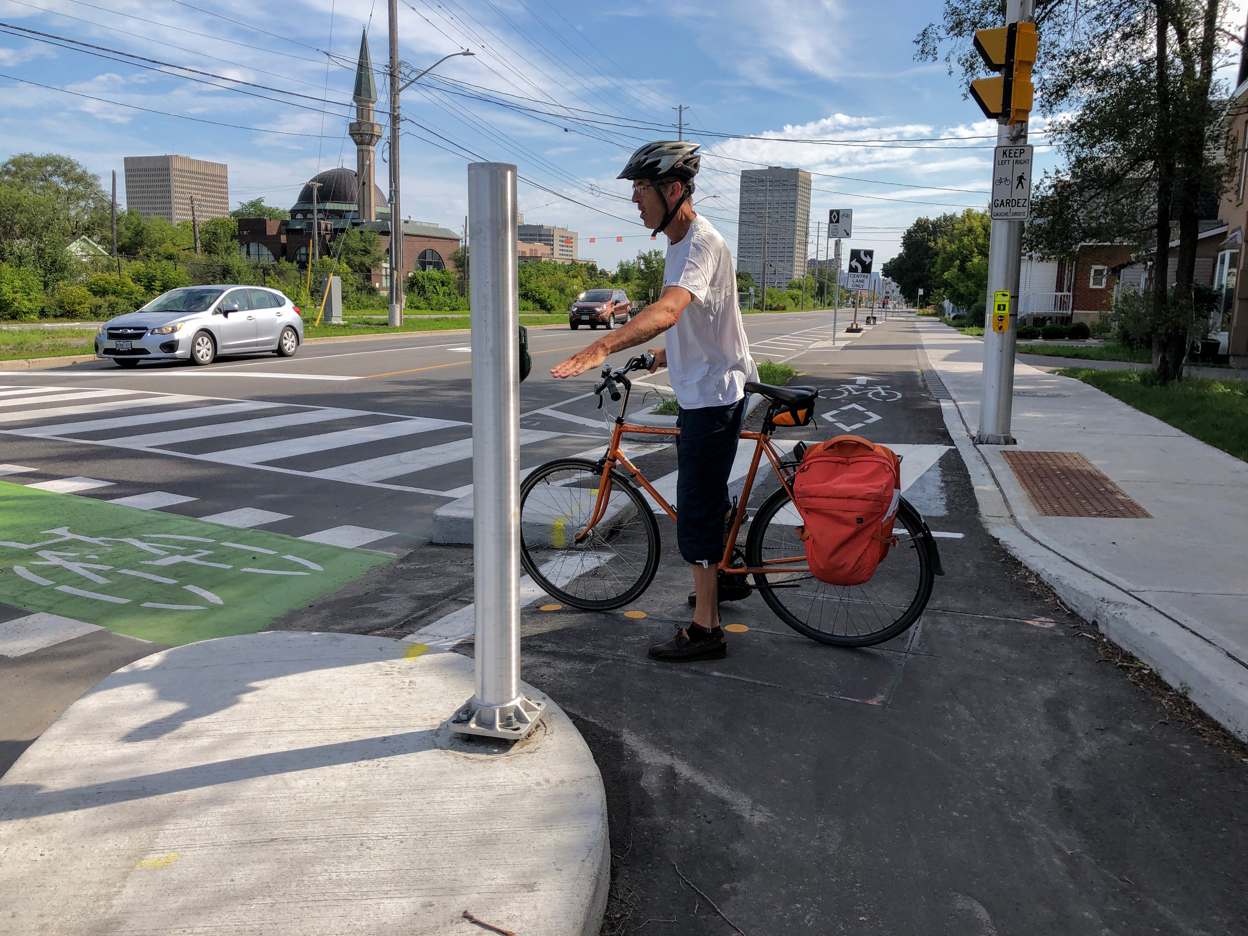
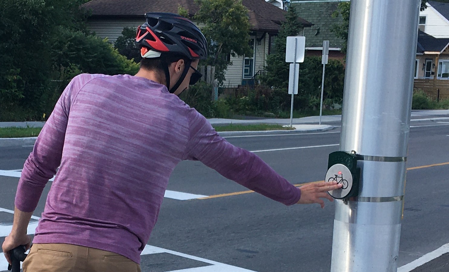
Matt: When you’re waiting to cross at an intersection, it’s helpful to know that you’ve been detected. Quite often I see cyclists moving over to push the pedestrian button, since that guarantees you’ve been “seen” by the signal. This is not ideal though because it provides a longer crossing than needed if there’s no pedestrians there. I really like the feedback light. It also helps to keep the signal cycle length as short as possible so cyclists don’t have to wait as long, a solution used widely in the Netherlands.
Matt: Thinking back to where we started, I’m glad we started our journey with a sit-down at Tunney’s to watch the street for a bit.
Hans: We actually saw a near collision between an OCTranspo bus and an SUV driver who didn’t look before merging. And we saw one of the city bike planners cycling by too.
Matt: I saw a man cycling with his kid on the front and his dog on a leash. Although that seems like a terrible idea, it does provide some indication of how comfortable people feel on the new infrastructure. When designing bike infrastructure, engineers are increasingly talking about designing for “all ages and abilities” – this includes users like children, seniors, and folks with physical impairments. Based on who we’ve seen riding here, I think the design has succeeded in reaching this goal. It makes me really excited for what’s to come in Ottawa!

Hans: The whole purpose of building protected cycling infrastructure is to create a safer environment for those who would like to bike but have no desire to mix with fast traffic. The City recognises that. If you are a confident cyclist who wants to keep up the speed, you’ll probably ride on the road. I foresee that Scott is not a road you’ll cycle all the way though, as the adjacent Ottawa River Pathway is probably faster for longer rides.
It is likely a route that people use for a short stretch coming from a side street, moving a few blocks over and crossing to an LRT station or towards an underpass at the Parkway to connect with the Ottawa River Pathway.
One last thing: I want to recognise Eric Darwin, who has been lobbying for safer cycling here for a decade and a half. You can read much of Scott’s ‘cycling history’ in his blog that is still online as it gives great insight on how this whole project developed (and sometimes not).
Modifying roads with new designs can often not be done overnight as staff has to stick to many rules in the Highway Traffic Act, the design manuals and internal procurement procedures etc. Not everyone knows though that Ottawa staff also plays an important role in changing provincial design manuals. Often novel designs start with an Ontario government approved exemption of the rules, which Ottawa regularly applies for, and then it takes several more years to make the changes in the manuals.
We should also recognise city staff who design our cycling infrastructure as they really stick their necks out to get things done. I sometimes see people on social media wondering if staff actually cycles and I can personally confirm that they do. I know of staff who take more pics of cycling infra when they are on their holidays than anything else!
Matt: Thanks again for the meet-up, Hans! What’s the next big project in Ottawa you’re excited about? We’ll have to make plans to check it out.
Hans: Yeah, now you are a Dad, you have responsibilities and we have to plan better! I haven’t been on Montreal Road for a long time and I believe that the rebuild including bike infrastructure will be finished in the fall. So our next ride might be in Vanier.
Sources and further reading:
BikeWest, RIP – West Side Action
Cycling along Albert / Scott – path vs road – West Side Action
Navigating Scott-Albert (east bound) – West Side Action
Kitchissippi Times: Early Days: Scott Street — How one of Ottawa’s oldest roadways took shape – Kitchissippi times
Photos by Matt and Hans, unless otherwise mentioned

Great article and awesome that you linked to Eric Darwin’s blog, it’s been one of my favorites for years!
LikeLike
THANKS! Hans-on-the-bike + Beyond-the-bike + West-Side-Action = BEST #ottbike BLOG POSTS EVER! Hope you guys come to Bells Corners to cycle down the strip. https://youtu.be/xLyY6pTbcrw
LikeLike