
Ottawa’s former Greenboro Busway is a case study of ambitious plans that were never fully realized. The story offers a valuable lesson for transport and urban planners: creating plans without community support – no matter how thoughtful – is a treacherous path.
We live in a time of the expansion of public transit. Billions of dollars are being spent around the world to build new rapid transit lines like subways, light rail transit, bus rapid transit, and dedicated busways. In Ottawa the situation is no different: the City has been on an ambitious path for the last five decades to construct its rapid transit network.
What first began as the “Transitway”, a network of bus-only and bus priority roadways is now being substantially updated to light rail transit on entirely grade-separated tracks, at great cost and with great potential for the city. Pre-pandemic, Ottawa had one of the highest rates of people using transit to get to work in North America, even more impressive given its relatively small size and significant amount of car-centric, suburban development patterns.
It is difficult to imagine then, that just 25 years ago Ottawa removed one of its Transitways, the Greenboro Busway, little more than 8 years after its opening. This post will summarize how the Greenboro Busway came to be, why it was removed, and what lessons this offers for transportation planning today.
Early Plans and Development (1950-1970’s)
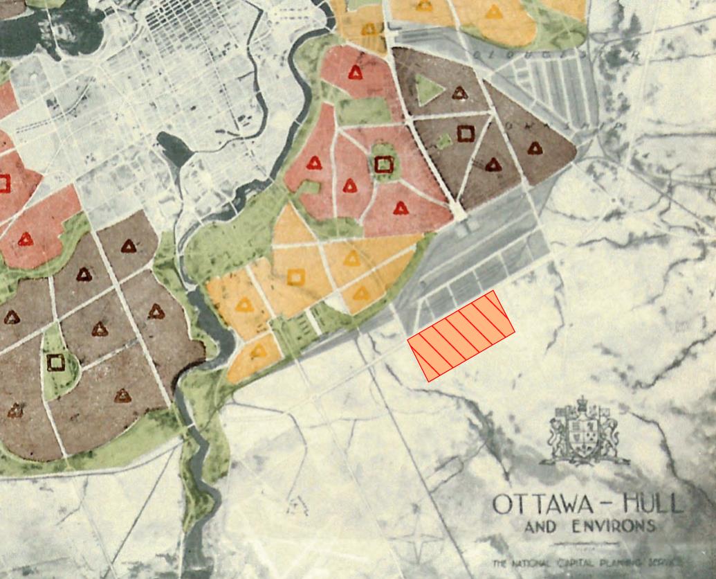
The story begins with a rather unexpected statement: the entire neighbourhood of Greenboro was never meant to be. In 1950 the City of Ottawa released its Plan for the National Capital (also known as the “Greber Report”) that aimed to guide the development of everything from land use and transportation to preservation of natural areas and the establishment of a Greenbelt. A core element of the plan was the relocation of Ottawa’s downtown heavy rail lines to the city’s periphery. As a result, one of the mainlines was relocated to its present day location south of Walkley Road, along with a large yard. The plan called for some industrial use surrounding the yard, but beyond this, the tracks would mark the southern edge of Ottawa, beyond which would be protected Greenbelt space.
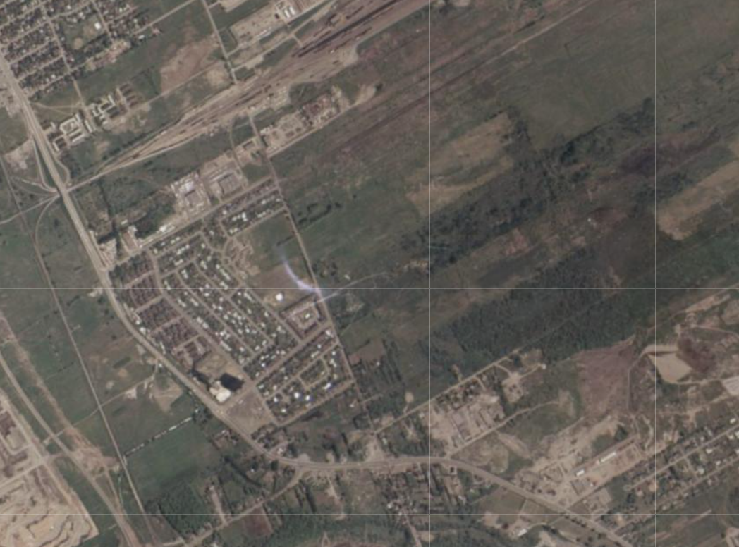
While many elements of Greber’s plan lasted, the southern development boundary did not, and by the late 1960’s, South Keys (the neighbourhood bordering the west edge of present-day Greenboro) was under construction and plans were forming for development to extend east. The rail line was relocated as planned, however, forming a significant barrier to north-south travel in the area and creating what would become a unique transportation challenge for the new neighbourhood.
By the late 1970’s, when planning for Greenboro was really starting to take off, South Keys was an established residential community with its own Residents Committee – an important element of this story for when eastward expansion began.
Planning (1970’s)
The 1970’s were an exciting time for planning in Ottawa’s south end, with big ideas being proposed for the new master planned community of Greenboro. Advertisements for new homes in Greenboro in 1978 pitched the neighbourhood as “a new, totally planned community which protests against traditional housing concepts by creating an environment in which people may live, work, be educated, shop and play – and walk rather than drive”.

The housing was developed in concentrated “clusters”, that allowed significant density while dedicating an impressive 33% of lands for recreational uses. As many as 35,000 people were anticipated to call Greenboro home by the time it was fully constructed (a density that would have rivaled even Ottawa’s densest downtown neighbourhoods), with a wide range of amenities intended to be fully accessible via the ambitious network of internal pathways.
Flyers for the development in 1978 pitched Greenboro as “a new, totally planned community which protests against traditional housing concepts by creating an environment in which people may live, work, be educated, shop and play – and walk rather than drive”.
Transportation planning was part of the innovation too. While conventional suburban development practice at the time was to border the community with arterial roads and provide windy “collector” roads running through the community, Greenboro’s long, slender shape required a different approach. Instead, the community was built without a central roadway, with traffic instead being directed out to the periphery roads. While this allowed for a low-traffic community centre, it left a challenge for providing transit service. Running buses along the outer roads would be highly inefficient and require two parallel routes to serve the north and south end, for a community that was just 1km across.
During the planning phase, there were concerns raised about the impacts of such a significant increase in the area’s population, especially on communities to the north which would bear the increased commuter traffic to downtown. In response, the Regional government and the City of Ottawa agreed that the development could proceed only if a very high level of transit service could be provided from the outset.
Enter the Greenboro Busway: a unique solution for a unique problem. Rather than running two parallel services at the north and south ends, a central transit spine would be created, allowing every resident of Greenboro to be within a 5-10 minute walk of a bus stop, accessed on foot via the rich pathway network.
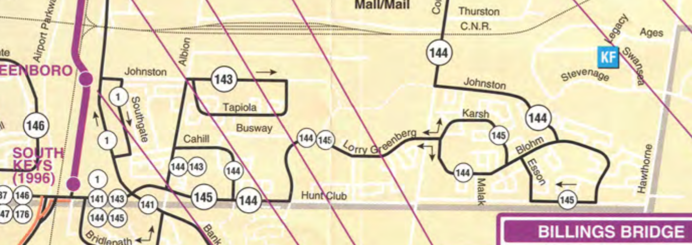
The busway would connect the new dense, mixed-use community to the planned south-east transitway to the west, which would eventually provide a fully grade-separated busway running from just west of Bank Street all the way to Hurdman and into downtown Ottawa.
The dedicated busway would provide fast, frequent service to this growing community and provide the necessary transportation capacity for Greenboro to become the dense, walkable, amenity-rich neighbourhood that it was planned to be.
Implementation (1980’s)
The time to implement the planned busway finally arrived in Fall 1984, when the City of Ottawa was responsible for approving the next phase of Greenboro’s development (Phase III). The first two phases east of Albion had been approved at this point and Phase I was substantially completed.
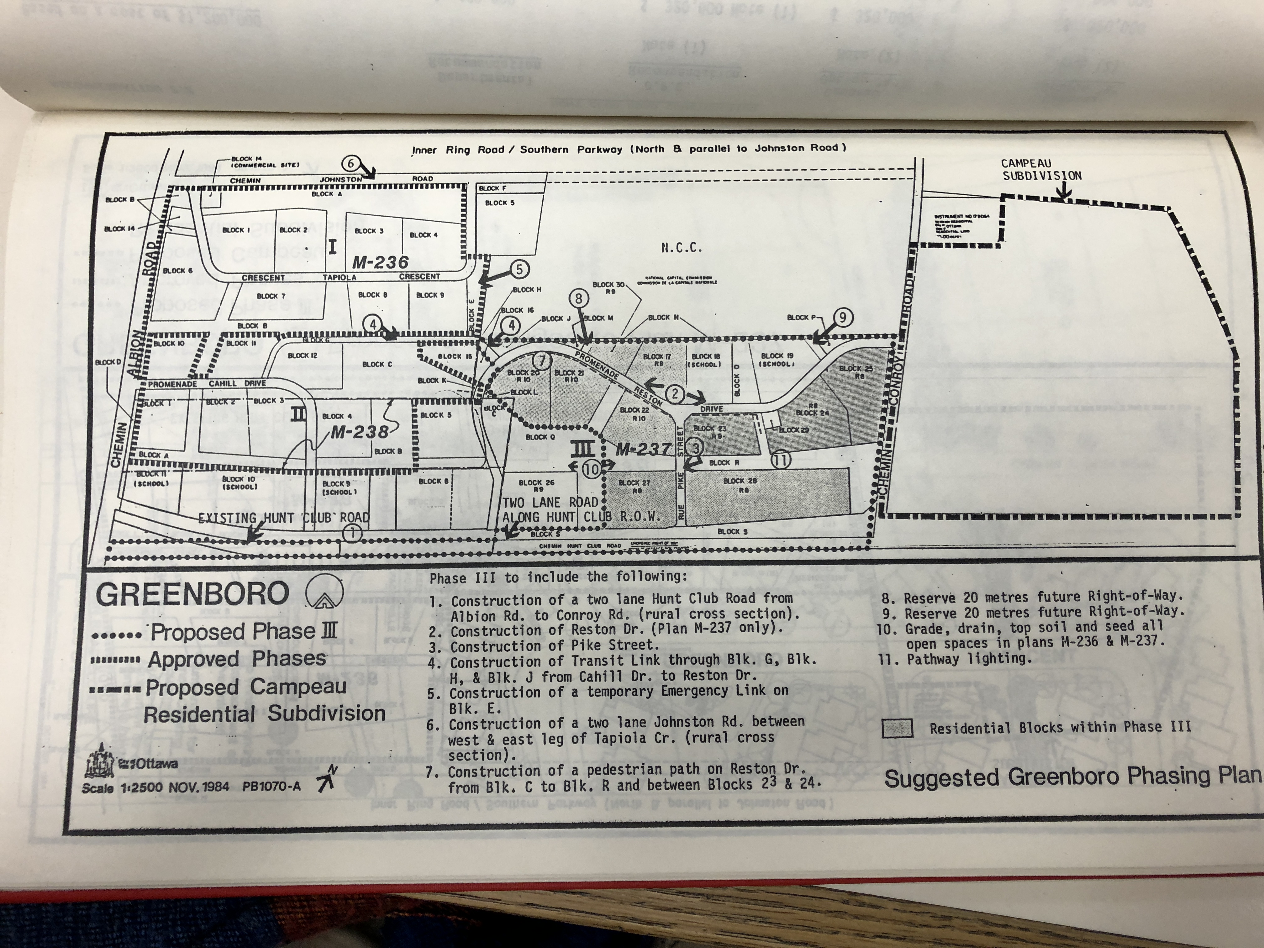
The consultations included several hot-topic items: first, Phase III was proposed to include the most significant density for the neighbourhood thus far, with residential apartment buildings as high as 10 storeys. Second, Phase III included construction of an east-west “transit link” between Cahill Drive and Reston Drive (later renamed Lorry Greenburg Drive) and protection of a 20-metre right-of-way to extend the busway further east in later phases of development. Third, the City was also moving forward with a public rental housing project to provide 99 units and a daycare at Albion and Cahill. Finally, plans were still unclear for expansion of roads to support the development.
The five sections below summarize some of the key discussions and events leading up to the approval of Phase III.
Greenboro Residents Committee, September 20, 1984
All of these elements drew the ire of residents. In a letter to the City dated September 20, 1984 the Greenboro Residents Committee (GRC) expressed resistance to the plan for mixed-density housing proposed for the next phase of Greenboro, instead insisting that “the existing make-up of Greenboro should be maintained” and that if the proposed plans were built, then “Greenboro will be transformed into a community radically different from the expectations of existing residents”. The GRC also opposed the bus-only road, expressing concern that it would create a hazard, running “through the heart of a recreation zone” and could “divide the community on a north-south basis”. They claimed that the busway would not be well-utilized, and that transit riders would have to walk farther to reach the central transitway, using “bike paths which may remain unplowed in the winter or flooded in spring”.
“Greenboro will be transformed into a community radically different from the expectations of existing residents”
Community Meeting, September 25, 1984
On September 25, 1984 a community meeting was held to discuss these topics, attracting an estimated 150 residents and running for over three hours. The meeting was summarized in the October 1984 edition of the “Our Community” newsletter. Several Cahill residents expressed opposition to the busway as it would require more buses travelling on the street; a resident was quoted, “You’ve missed the point. You’re just planning a transit system. You should be planning for people.” The article’s author cleverly summed up the predicament, concluding that it “seems everybody’s in favour of better bus service, improved roads, subsidized housing, and more facilities. But nobody wants it on their street!”
“Everybody’s in favour of better bus service, improved roads, subsidized housing, and more facilities. But nobody wants it on their street!”
Concerned Citizens of Cahill Drive Area, October 30, 1984
The South Keys Community and School Association also was part of the conversation. In a letter dated October 30, 1984, the “Concerned Citizens of Cahill Drive Area” expressed serious concern that “a poorly planned and rapidly expanding Greenboro is having its transport problems dumped on the residents of South Keys.” The group was “totally opposed” to the creation of the busway, which would include buses continuing to run on Cahill Drive as part of the main route. Instead the group insisted that existing roads be used and transit service ultimately be provided via a loop service around the entire community, writing that “although a central route might be a transit planner’s dream, the convenience and comfort to the transit rider seems more important. The time spent riding this proposed “loop” would roughly equate to the time spent walking the planner’s “central” route, especially in our climate”. The letter contained nine pages of signatures from residents.
“a poorly planned and rapidly expanding Greenboro is having its transport problems dumped on the residents of South Keys.”
Regional Municipality of Ottawa-Carleton, November 9, 1984
Given the opposition voiced by residents of both South Keys and Greenboro, the Regional Municipality of Ottawa-Carleton, which was responsible for regional roads and OC Transpo at the time, joined the conversation. In a letter to the City of Ottawa dated November 9, 1984, the Region reaffirmed its strong position in support of the busway. The letter included a comparison of alternatives proposed by residents and confirmed “the superiority of the original servicing strategy”, finding that alternatives could cost $30,000 more per year to operate, increase route lengths by 1.4km, and add four minutes of travel time to transit passengers’ journeys. The letter acknowledged the concerns expressed by residents about pedestrian safety, noise, and vibrations, and assured that the proposed routing would “minimize such impacts but that the Region supports the provision of opportunities for their participation in design details”. the Region reminded the City in its letter that its initial approval of the Greenboro development was contingent upon providing quality transit service, and that if development proceeded without the busway “it would be tantamount to abandoning the regional transit plan which justified the early development of the community”.
Proceeding without the busway “would be tantamount to abandoning the regional transit plan which justified the early development of the community”
Report to Council, November 23, 1984
In a report to City Council on November 23, 1984, the City of Ottawa made its final recommendations for the next phase of Greenboro’s development. The report contained some “wins” for the community through the construction of more roads as part of the development, and satisfied the needs of the Region by requiring the developer to construct the busway link.
Construction and Operation (1987-1995)
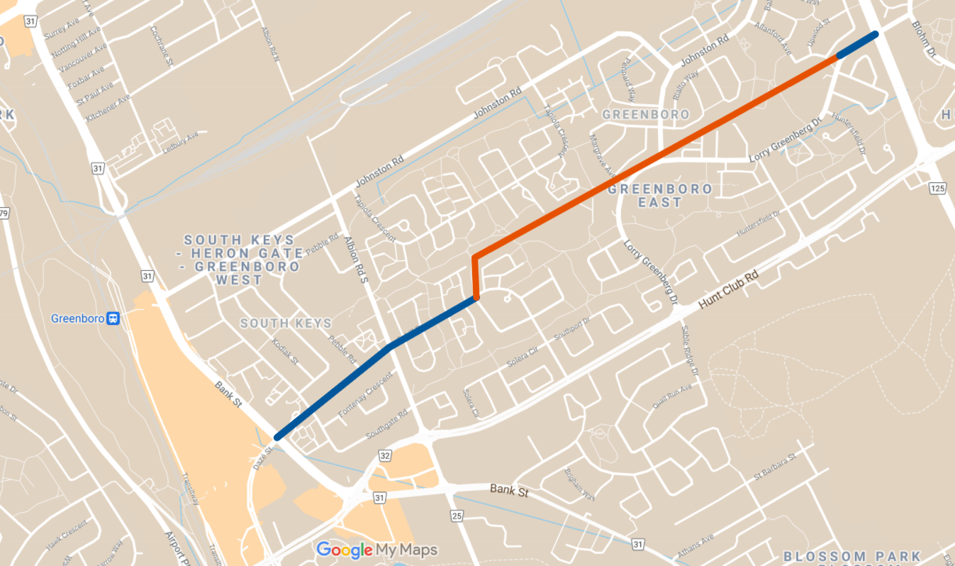
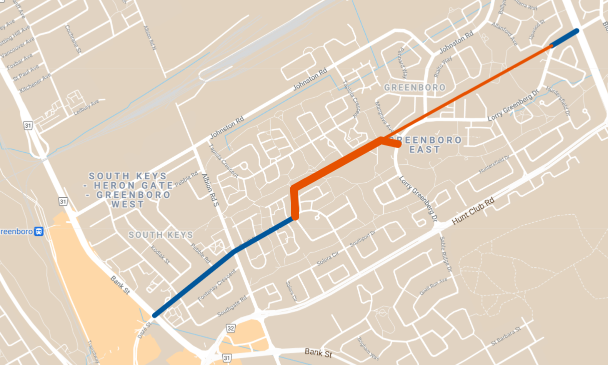
On June 28, 1987 the busway opened and OC Transpo began service on the central transit spine.
Route 144 provided “regular” service and Route 45 providing peak-period service on the Greenboro Busway. Route 144 continued north to terminate at Billings Bridge, while Route 45 operated through downtown to terminate at Lebreton Flats. The South-East Transitway (dashed blue line) was still under construction at the time.

The bus service plan for Greenboro remained largely unchanged for the next eight years as development continued. By 1994, the final full year of operation for the Greenboro Busway, the city-wide Transitway network had been largely built out, with the final phase of the south-east Transitway expected to be completed the following year.
Abandonment & Removal (1990-2000’s)
In November 1989 – just five years after the busway’s approval and two years after its opening – OC Transpo conducted a review of the busway and decided to phase out bus service using it. The initial vision for Greenboro had not played out from a development perspective – the dense, mixed-use community envisioned by City planners had been watered down significantly to mostly low-density housing with no commercial uses at all. The planned population of up to 35,000 residents ultimately became a 2016 population of about 13,000. Though Regional staff recommended preserving the eastern segment of the corridor for future transit use (which was protected for but never constructed), the Regional Council declared the busway as surplus lands in June 1990.
In a 1996 research paper titled Public Policy and Transit Oriented Development: Six International Case Studies, the Greenboro Busway was concluded as a “missed opportunity” for Ottawa: while the central transit spine had been envisioned as a transit-oriented development corridor lined with commercial uses and apartments, developers had instead gained political support to build parkland, a school, and recreational facilities adjacent to the busway. The busway’s utility was further diminished by:
- Additional low-density residential development south and east of Greenboro, reducing the efficiency of the central service pattern
- Development of the Transitway at South Keys Shopping Centre, which did not allow buses to efficiently reach Cahill/Daze from the station
The ultimate nail in the coffin was likely that the strong community opposition to the busway persisted throughout its short life. Greenboro residents wanted “buses out of backyards”, and developers resisted too, supposedly misleading prospective buyers by pitching the busway route as a pathway.
On September 2, 1995 – just eight years after it opened – OC Transpo ran its final trip on the Greenboro Busway. Routes were adjusted to also no longer use Cahill between Bank and Albion – a victory for Cahill Drive residents – and instead of serving the busway through Greenboro, buses diverted south to Hunt Club to serve the new development there.
For another four years, the busway sat unused and barricaded at each end, attracting litter, garbage, and graffiti, while the City and the Region worked out what would be done with the lands. Finally, in a City of Ottawa report to council on July 20, 1999 it was reported that agreement had been reached with the Region to transfer the busway lands to the City for $1.00. In addition, the Region would pay the City $125,000 to cover the cost of removing the asphalt and reinstating it with sod, a move that was supported by the South Keys Greenboro Community Association.
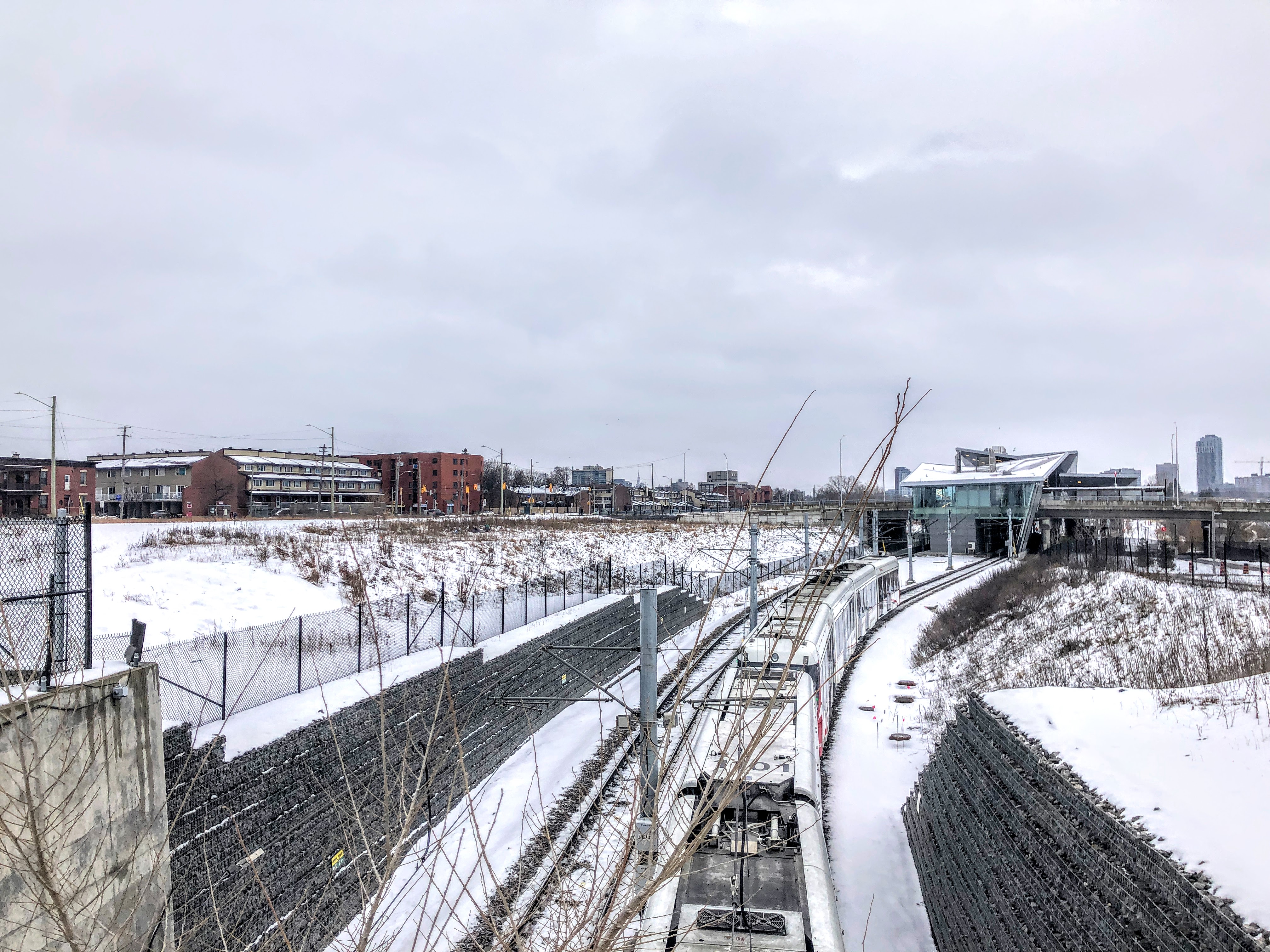
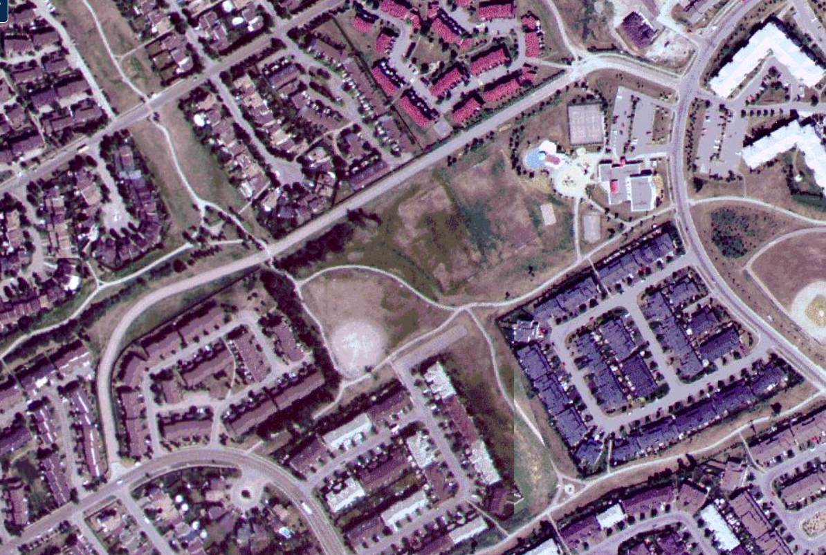
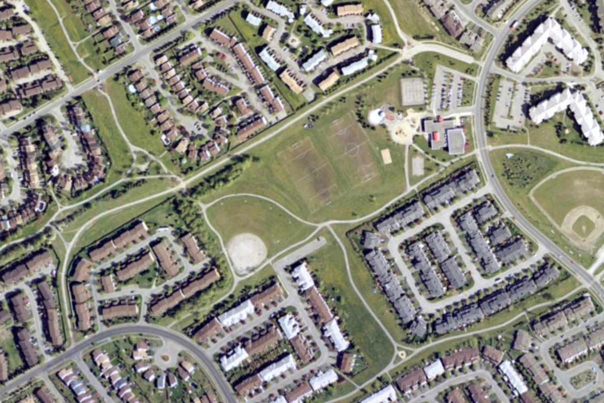
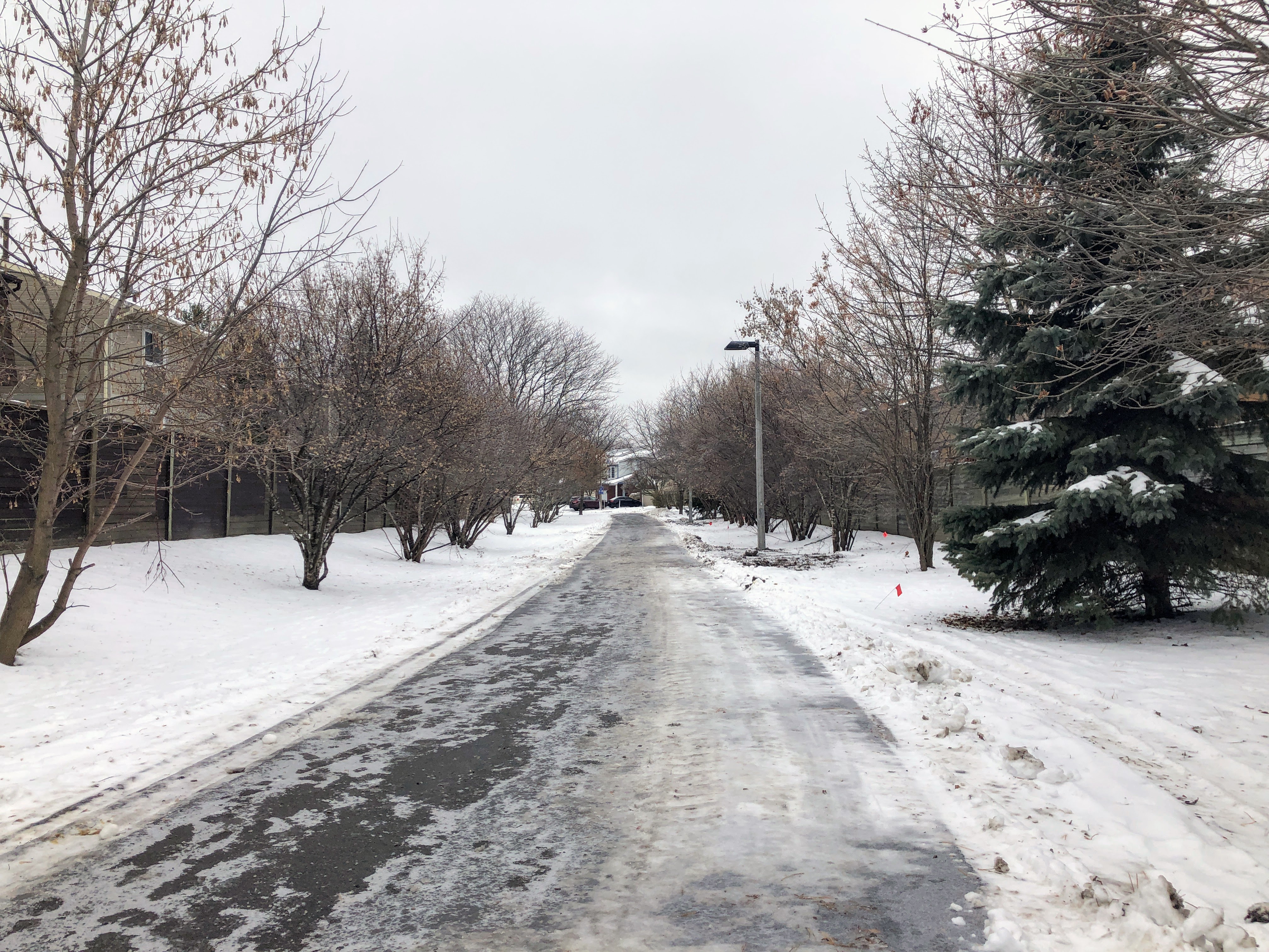
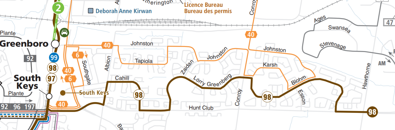
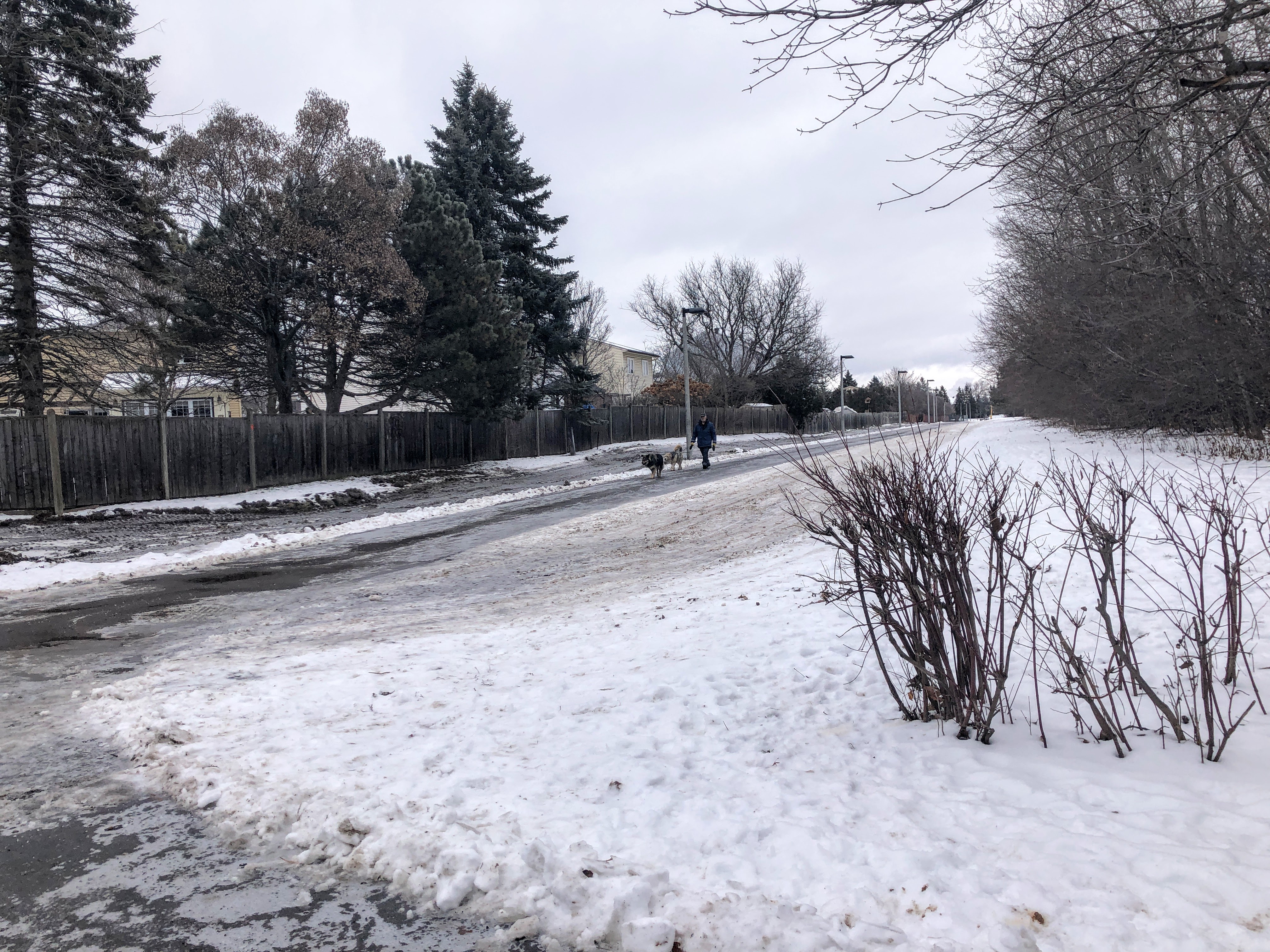
By 2002, the busway had been officially removed and replaced with the pathway that exists today.
Conclusions and Remarks
To summarize this story:
- Greenboro was planned as a dense, mixed-use community where its up to 35,000 residents would be able to walk to amenities: “an environment in which people may live, work, be educated, shop and play – and walk rather than drive”
- To support the significant planned density, a central transit spine was included in the plans and considered by the Region to be a prerequisite for the success of the development
- As residents moved into the early development phases, support for density and the central transit spine eroded as community groups formed to express opposition to both of these elements, worried that these would transform the community into one that was “radically different from the expectations of existing residents”
- Eventually the developers changed their tune as well, watering down the plans into lower-density, exclusively residential development, with parks fronting onto the busway rather than retail
- Though the busway was constructed, persistent community opposition combined with transit-unfriendly development patterns led to its abandonment by OC Transpo just 8 years later and its eventual conversion to a pathway by the City of Ottawa
Today, Greenboro’s bus service pattern looks much more like the “alternative” plans proposed by residents back in 1984, exactly those OC Transpo had sought to avoid at the time. Greenboro is served by two parallel bus routes covering the north and south portions of the neighbourhood, both operating in circuitous, indirect alignments. As an example, the 4km trip between South Keys station and Lorry Greenburg / Conroy at the east end of Greenboro takes 20 minutes by transit, compared to just 7 minutes by car or 14 minutes by bike.
So what is the lesson here? The story of the Greenboro busway in many ways is not unique – it is a story of friction between ambitious plans, community concerns about traffic and density, public officials responding to the loudest voices, and developers ultimately doing what is easiest and lowest risk for them.
It is worth questioning if there was ever a scenario where Greenboro could have developed as envisioned:
- If South Keys had not been developed first, would community opposition have been lower since buses would not need to operate frequently on an established residential street?
- If political support for the initial vision had remained consistently strong, could the developers have been compelled to build what was planned?
- Was there a possibility for a compromise possible between the City and community groups to keep the busway alignment, had a more active effort been made to engage more people?
I believe the lesson the Greenboro Busway offers for transport and urban planners is clear: creating ambitious plans without community support is a treacherous path. No matter how inherently good, visionary, innovative, or environmentally friendly those plans may be, community resistance is a powerful force that does not simply go away with time. On the flipside however, if meaningful efforts are made to build community relationships and gain enough support for a plan, just about anything is possible.
While I believe that OC Transpo was correct to defend the busway from an efficiency and passenger travel time perspective, when opposition from the community included statements like “You’re just planning a transit system. You should be planning for people”, it is clear that OC Transpo and the City had failed to meaningfully connect with residents on this. The two groups might as well have been speaking two different languages.
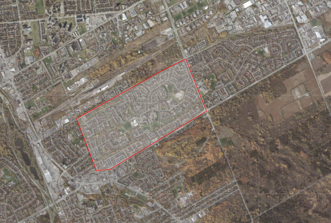
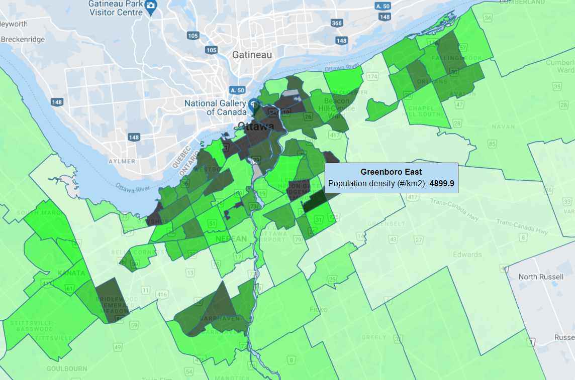
Finally, Greenboro still remains quite unique as a suburb. While the vision for up to 35,000 residents did not play out as intended, its population density of 4,900 residents per square kilometre actually makes it one of Ottawa’s densest suburbs – around 50% denser than the densest parts of Orleans and Barrhaven, and even higher than some of Ottawa’s oldest, most walkable suburbs including The Glebe, Old Ottawa South, Old Ottawa East, and Westboro, all while providing exceptional amounts of greenspace. Greenboro’s dense network of pathways separated entirely from traffic also gives it the second-highest bicycle network density of any neighbourhood in the city.
Greenboro’s evolution is far from over, just as the evolution of our cities and suburbs is far from over.
Sources
All sections except for Conclusions and Remarks are based entirely on the following websites, print sources, and conversations:
- 1950 Plan for the National Capital (the “Greber Report”)
- Historical OC Transpo Network Maps from the Carleton University MacOdrum Library
- Public Policy and Transit Oriented Development: Six International Case Studies (Published March 1996 by the Transit Cooperative Research Program)
- Geo Ottawa
- Phone interview with Sean Rathwell, former Manager of Service Planning for OC Transpo, November 29, 2021
- Property Civic Acquisition – 1465 Cahill Drive (Formerly Known as Greenboro Busway), July 20, 1999 (special thanks to Shawn Getter for identifying this source)
- A Historical Timeline for the Township of Gloucester, Eastview and Rockcliffe Park, published by the Gloucester Historical Society
- Innovation in Design – Greenboro, Mid-Century Modern (and beyond) Housing Ottawa
- Email exchange with Glenn Clark, President of the Gloucester Historical Society, January 1, 2022
- Ottawa Neighbourhood Study Maps
The following were accessed in print at the Ottawa Public Library, Central Branch on November 19, 2021:
- September 20, 1984, letter to Ottawa planning department from Greenboro Residents Committee
- October 30, 1984, letter to the Alderman from the Concerned Citizens of Cahill Drive Area
- “Lively Meeting on Greenboro Plans”, October 1984 edition of “Our Community”
- November 9, 1984, letter from Regional Municipality of Ottawa-Carleton to Ottawa planning department
- November 23, 1984 Report to Council on Final Recommendations of Greenboro Phasing Plan
The following Ottawa Citizen clippings were identified with the help of Glenn Clark, President of the Gloucester Historical Society:
- South Keys: Residents Oppose Bus Route, February 12, 1985
- OC Transpo may drop Greenboro extension, October 5, 1989
- Bus-only route to be dropped, November 2, 1989
- Region gives up on Greenboro busway, June 28, 1990 & correction, June 30, 1990

Thanks for this Matt. My parents lived just west of Greenboro (and Albion), off Southgate. I’d often walk through Greenboro and was amazed there was a busway in the midst of this subdivision. Seemed very progressive, as were the generous walking paths. Nonetheless I don’t recall seeing many buses at all on this busway (anecdata, which I know has doubtful validity). Before the Transitway opened, the bus along Southgate, or the more frequent Bank bus were my options. I don’t think the bus route to Greenboro would ever be busy enough to warrant a busway. Nonetheless I realized it was to encourage drivers to take the bus, although I recall seeing a few cars taking the busway, probably higher number of busway users than the buses themselves!
A good idea, but as you state, not the correct final density to warrant the busway.
LikeLike
Interesting history – I also appreciate the time you took to include figures. How do you think transportation engineers and planners can more effectively engage with residents who may be antipathic towards non-car-centric infrastructure in their neighbourhood? A community rallying together to kill bike and bus oriented plans for their area seems to be a persistent problem.
LikeLike