
What to do with our historic main streets? This is a challenge many municipalities are facing today across Canada and the US, and this is the question of the day for Ottawa’s Bank Street. Originally one of the city’s streetcar routes, in the years before WWII, Bank Street grew outward at a human scale, with a narrow right-of-way and street-facing retail. In the post-war era, Bank Street was extended south as a full-blown suburban arterial roadway, funneling traffic into the city centre from car-dependent suburbs. What might have one day been a pleasant shopping street for pedestrians became a noisy car-dominated stroad carrying multiple lanes of traffic, where the buses that replaced the original streetcars are constantly mired in congestion.

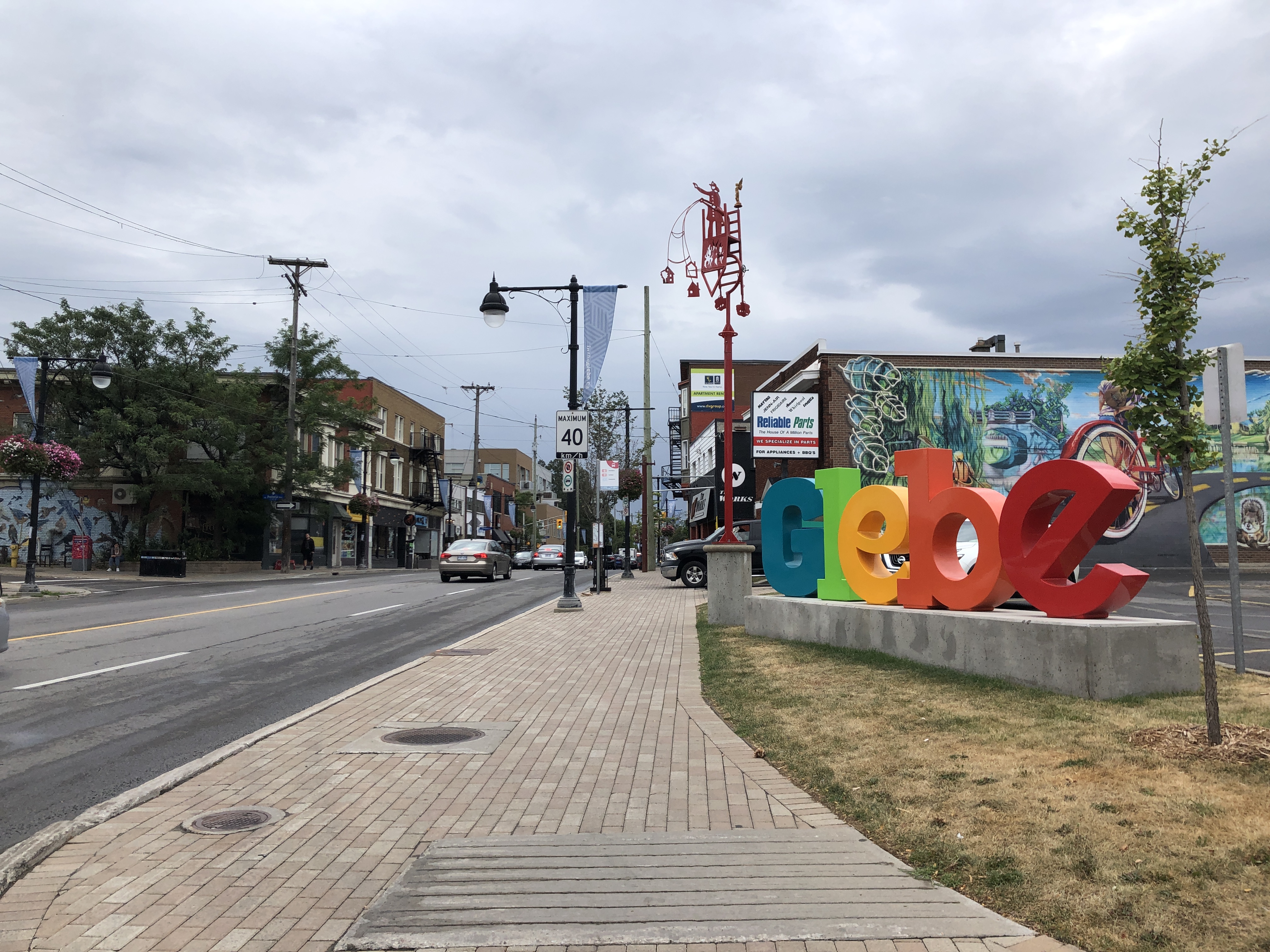
Today, the City is investigating a re-think of one of the most vital segments of Bank Street, the portion through The Glebe, a wealthy neighbourhood full of retail and anchored by a major entertainment destination, Lansdowne Park. The goal of the re-think is to better prioritize transit and active transportation on this key corridor.
Why is this street such a tough nut to crack? It is trying to do too many things: it’s a designated truck route, an arterial for cars, a “main street”, and a transit priority route. How do you prioritize trucks, cars, pedestrians, retail, and buses in a roughly 20 metre right-of-way? Quite simply, you can’t. The problem of Bank Street today is that it claims to prioritize all road users, and as a result fails to effectively prioritize any of them.
Later this month, the City will host a public info session and begin introducing design concepts for addressing the project goals. Before those concepts see the light of day (I haven’t seen them yet either), I think it’s important to identify some radical – and systemic – ideas that could make the task of redesigning the street much easier.
Remove the Truck Route Designation
Ottawa’s truck route network tells truck drivers where they should drive to circulate goods throughout the city. It also steers street designers to accommodate large trucks in lane widths and at intersections (via larger turning radii). There are absolutely destinations along the corridor that require trucks for delivery, but should the corridor be designed to encourage truck travel? Absolutely not – trucks pose one of the biggest threats to pedestrians and cyclists, and are noisy and polluting. Adjacent corridors like Riverside Drive are much more appropriate roads for trucks for getting through the area.

Remove the Arterial Roadway Designation
One of the most radical ideas for Bank Street is to remove its classification as an arterial road, thereby discouraging it as a route for through traffic. There is absolutely a need for traffic to access destinations along the corridor, but should someone be able – even encouraged – to use it as a driving route to commute downtown? I’m a south end resident who takes transit or cycles to work and when I ask Google Maps the best driving route to get to work downtown, it recommends Bank Street, straight through The Glebe. There are thousands of car trips made daily on this corridor that don’t visit businesses, and hold up traffic for everyone else (including buses) at intersections.

Rather than directing through traffic to and from downtown along Bank Street, through traffic can be diverted around The Glebe with a thoughtful traffic circulation plan. No through traffic on Bank Street means less cars, and less cars means less crashes, more capacity for buses, and extra space that can be repurposed for other modes.
Remove the Traffic Lights
The purpose of traffic lights is to manage traffic, and with less traffic (by removing the arterial designation), you need less traffic lights. With less traffic lights, you can have better flow for the traffic that remains (especially buses), and with one travel lane in each direction and traffic calming, you can build a street that’s easy and safe to cross with yield-controlled crosswalks rather than pedestrian signals. All of the signals along the study area manage traffic from lower volume side streets, so traffic on Bank Street is the reason for the signals – reduce Bank Street volumes and speeds and you remove the need for signals.
Travel times for cars and buses along the study area today likely ranges from 10-20 km/h at most times, a terribly slow speed even for urban travel. With a target speed of 30 km/h and stopping only when pedestrians are crossing the street, you could likely get more reliable average speeds closer to 25 km/h.
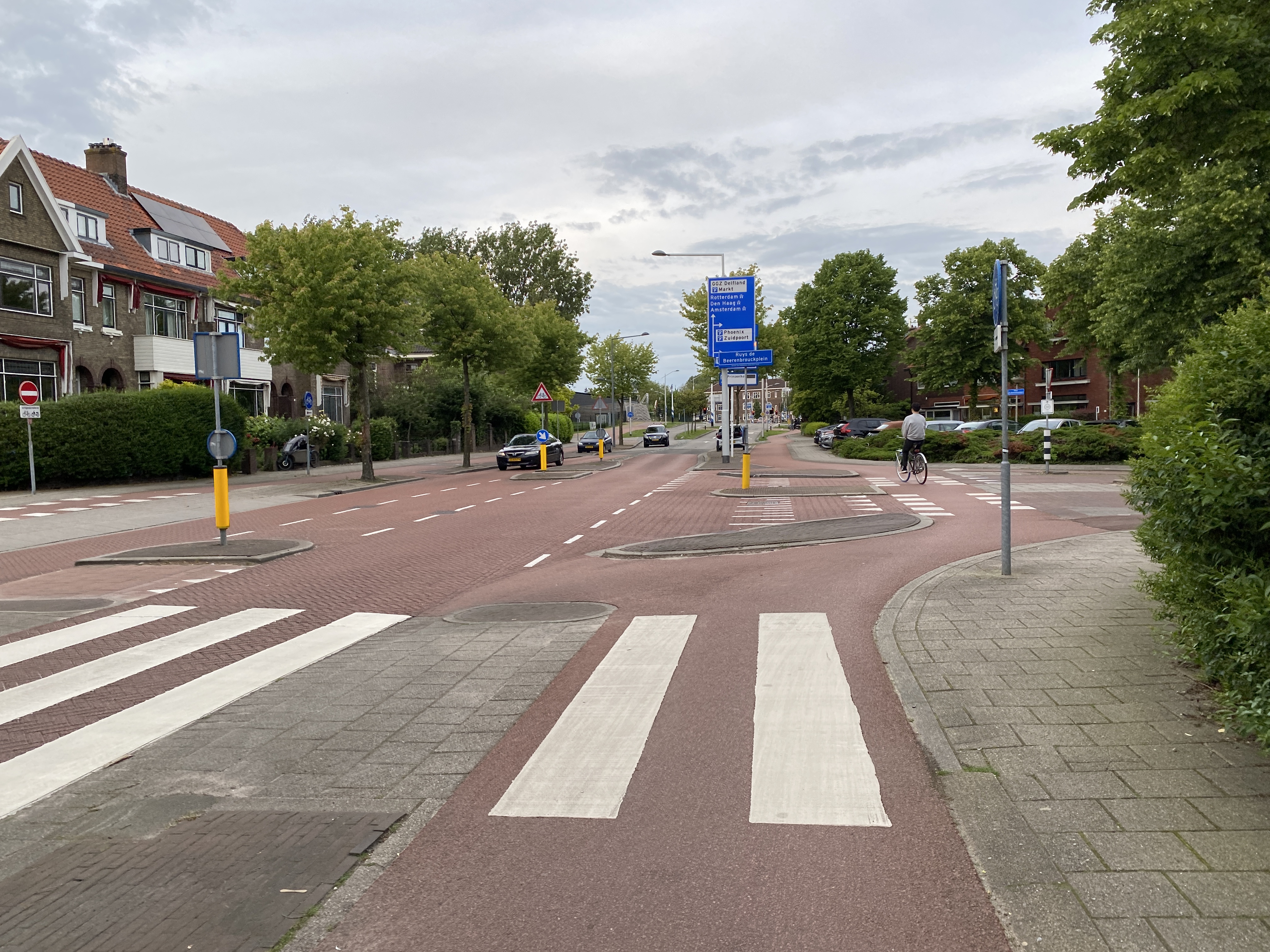
Compact, single-lane “distributor” roads are highly common in the Netherlands and are carefully designed to only need traffic signals at limited intervals. At unsignalized intersections you’ll find crosswalks, medians, speed tables, and other safety features to provide safe crossing opportunities for road users.
Conclusions
I applaud the City’s decision to study solutions to improve walking, cycling, and transit on Bank Street. While conventional solutions may yield incremental improvements, there are higher-level options available for more radical change. By removing through cars and trucks we can provide better access for the traffic that remains, create a quieter and safer environment for pedestrians and cyclists, and prioritize transit without sacrificing valuable space for bus lanes.

2 Comments